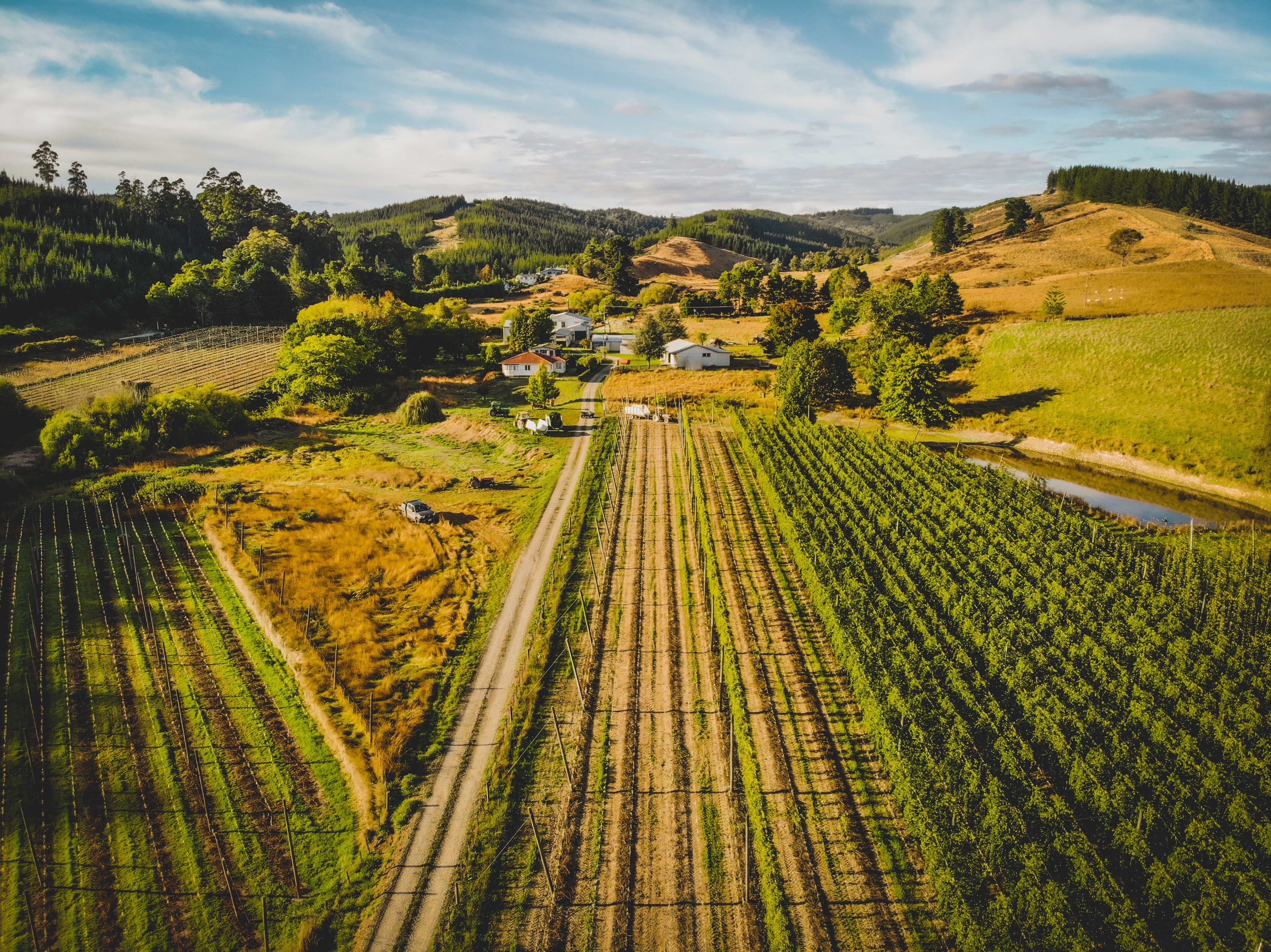
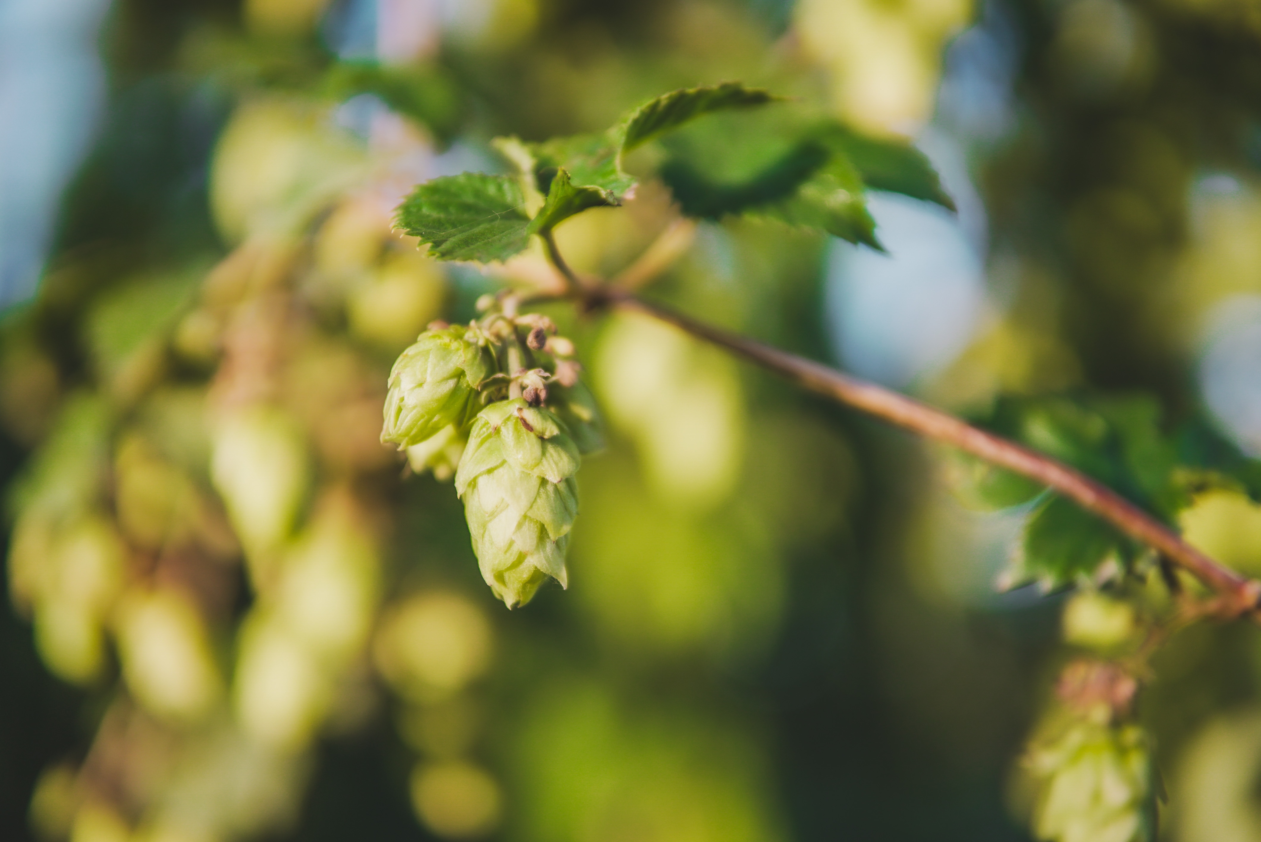
So it’s officially autumn in New Zealand, but our trip to the Tasman region in late March let us hold onto summer just a little longer! The northwestern corner of the south island is dotted with beautiful beaches, ranging from idyllic golden bays to roaring ocean and windswept cliffs and islands. The region is also abundant in horticulture and is the home of hops in our humble little nation. We were lucky to see the annual hop harvest in motion at Freestyle Hops, and boy-oh-boy did we inhale the fantastic smell of those hop cones 😀
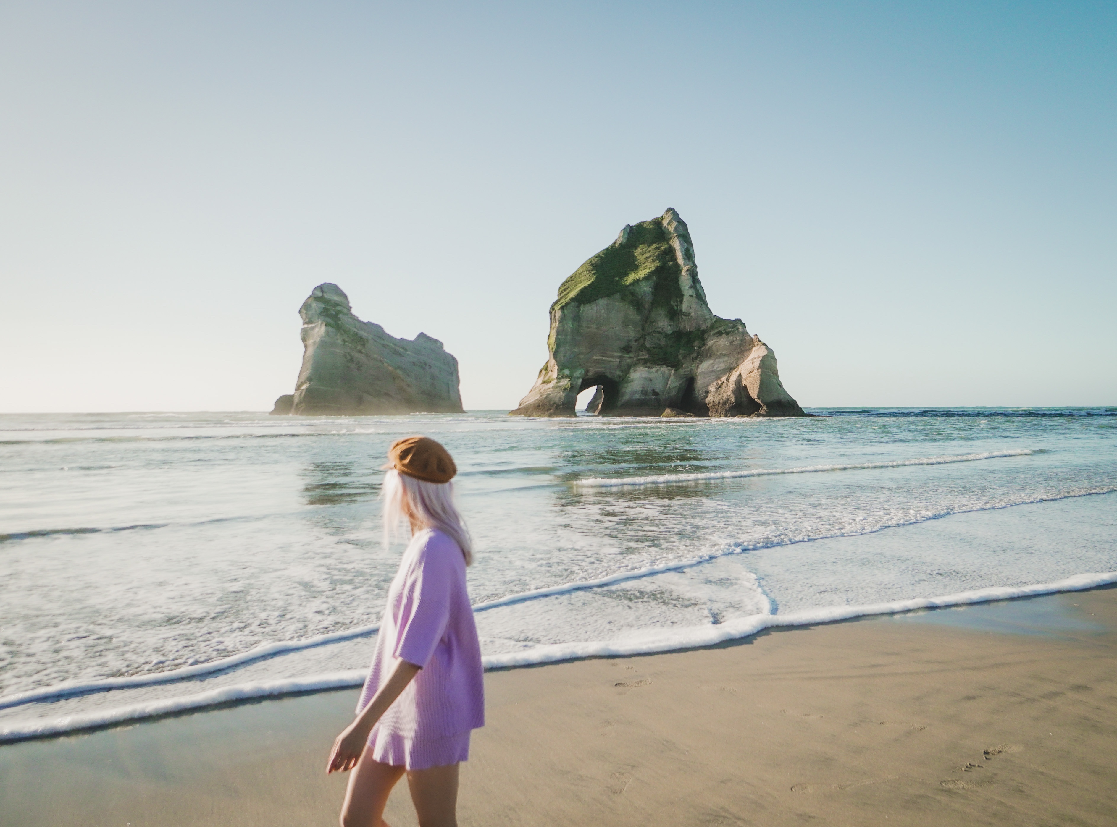
The crowning jewel of the week and the inspiration for trip planning was Wharariki Beach, yes, that beach made famous as the wallpaper and lock screen of Windows 10. So for this blog post, I will start at the northwest tip of the region, tracing back down to Upper Moutere and Māpua. Keep reading to discover the best photography locations, lookout points and trails to stretch your legs out that Tasman has to offer.
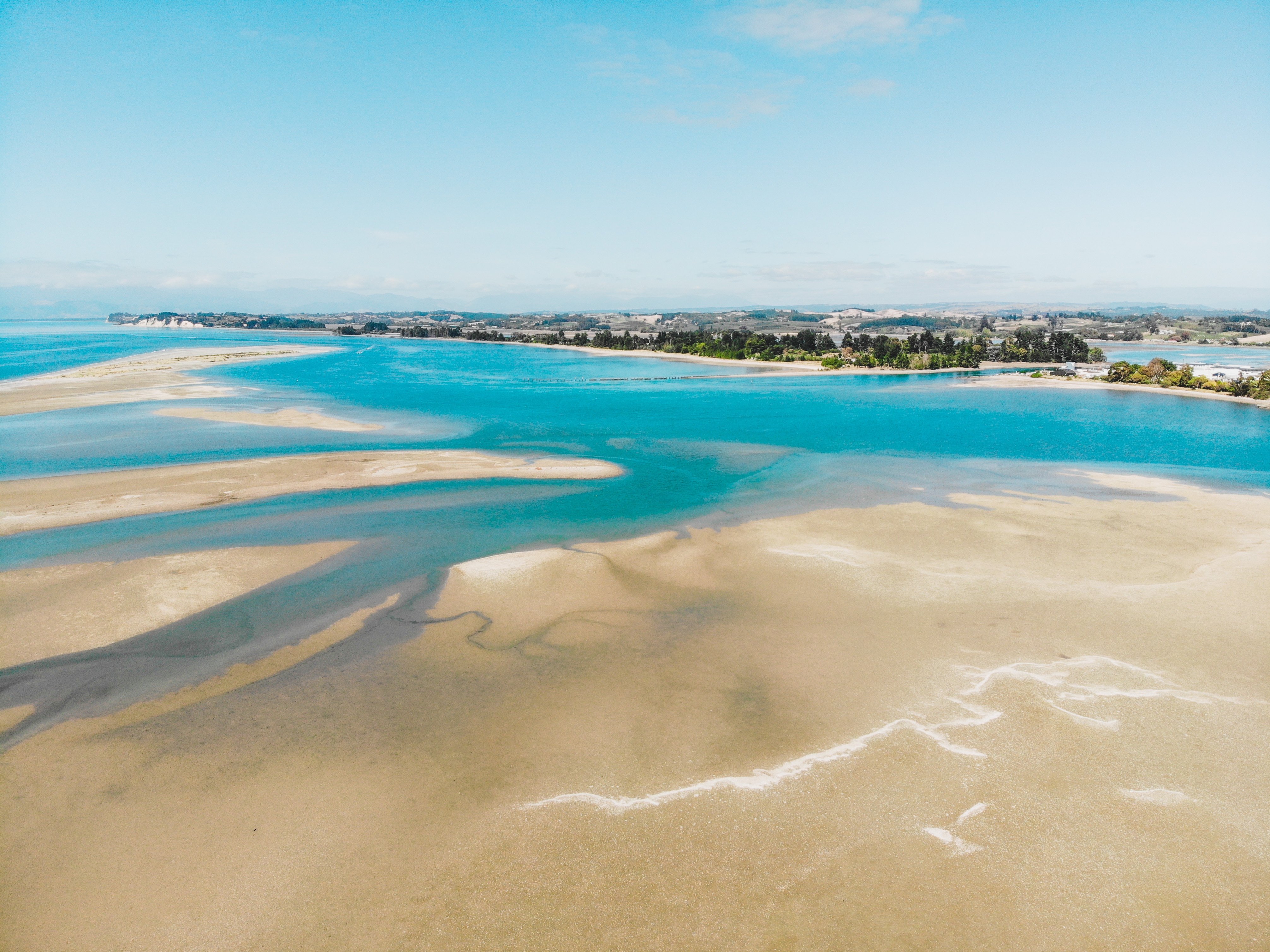
Farewell Spit and Puponga Farm Park
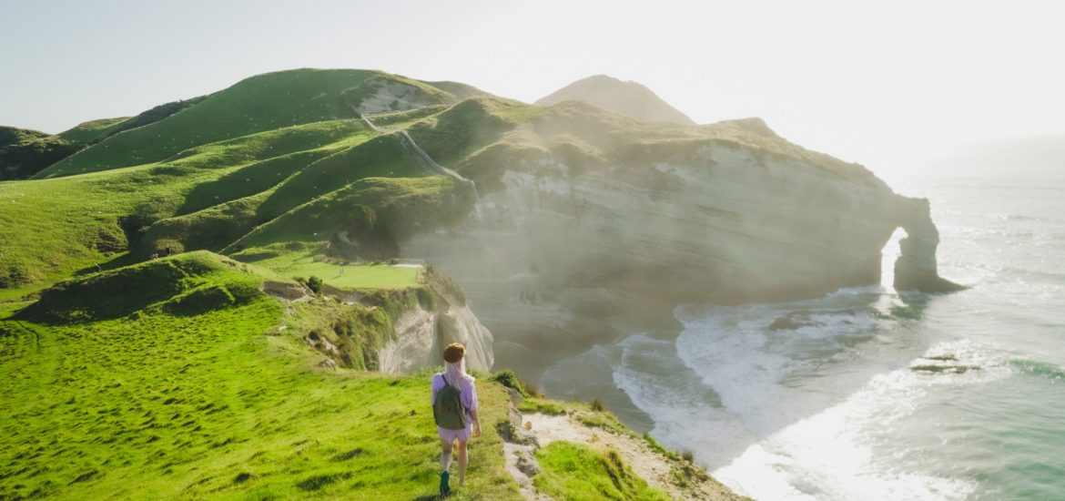
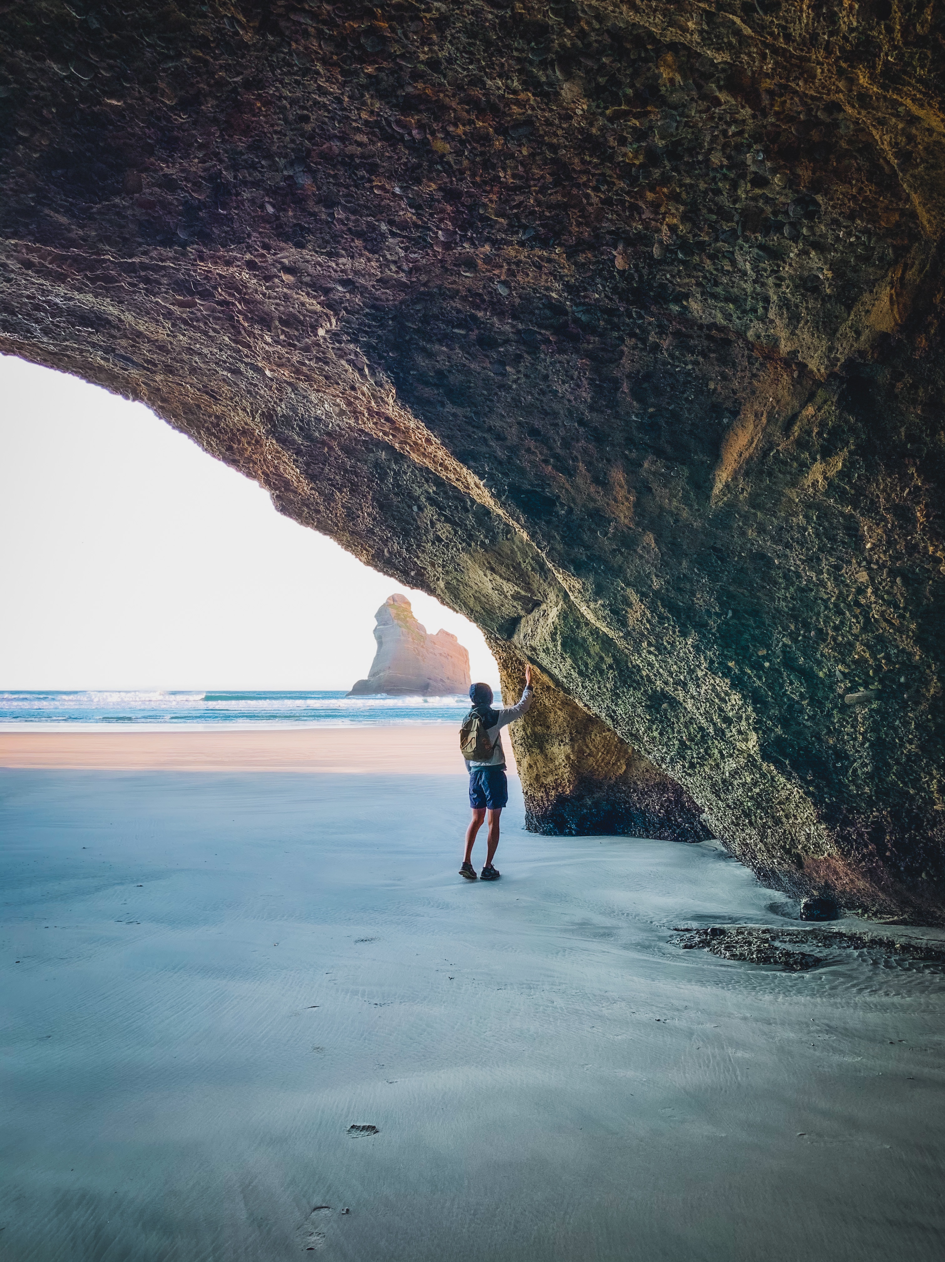
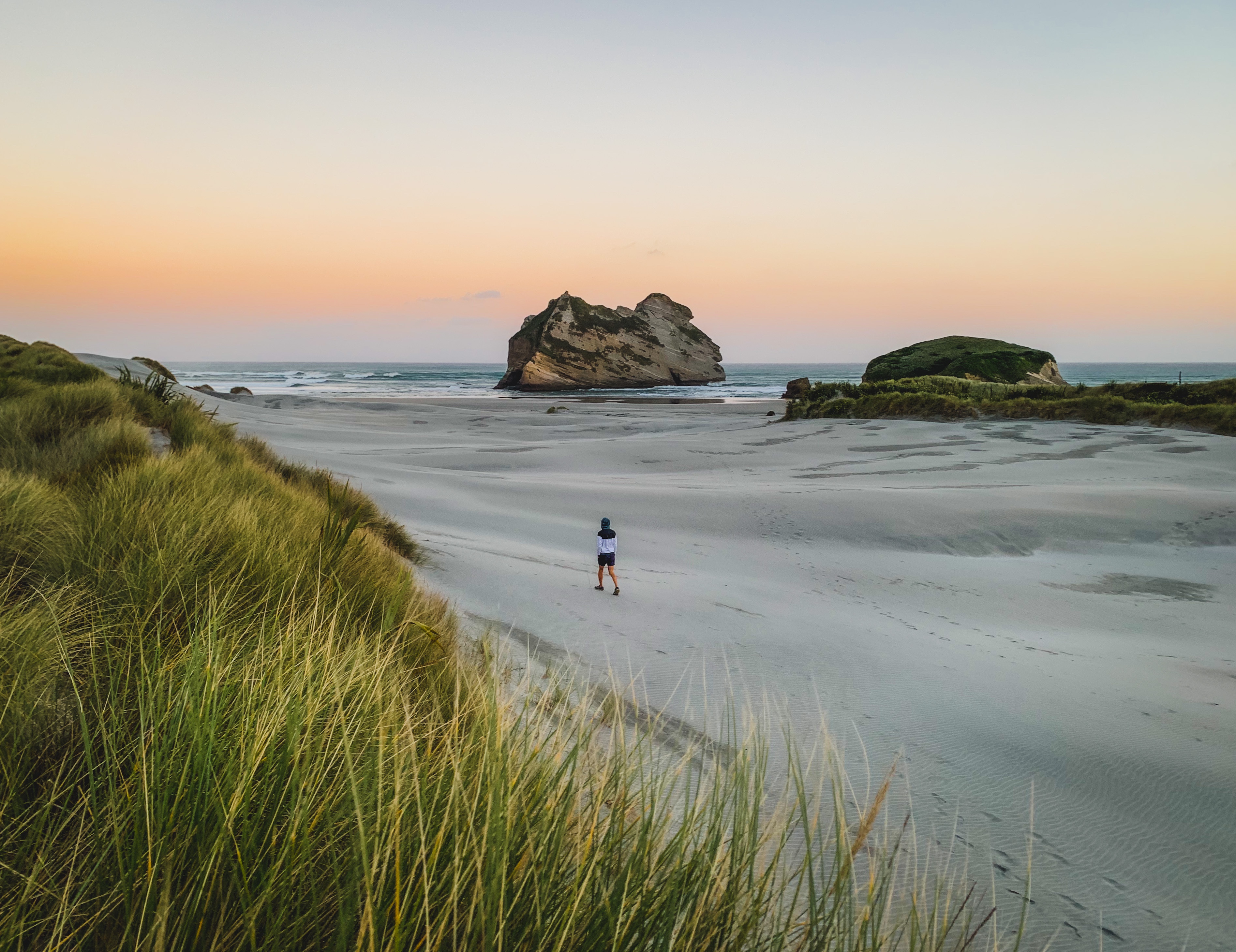
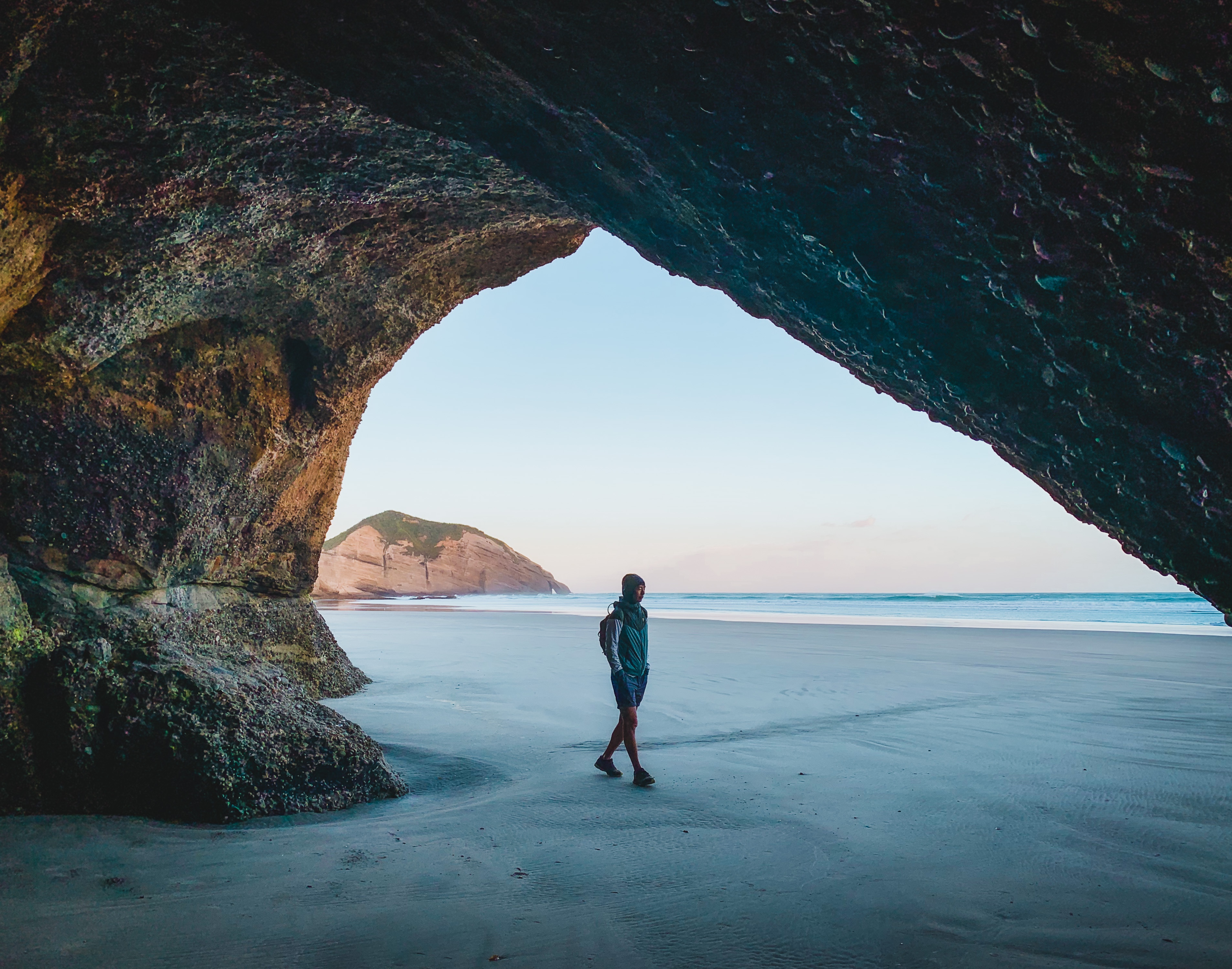
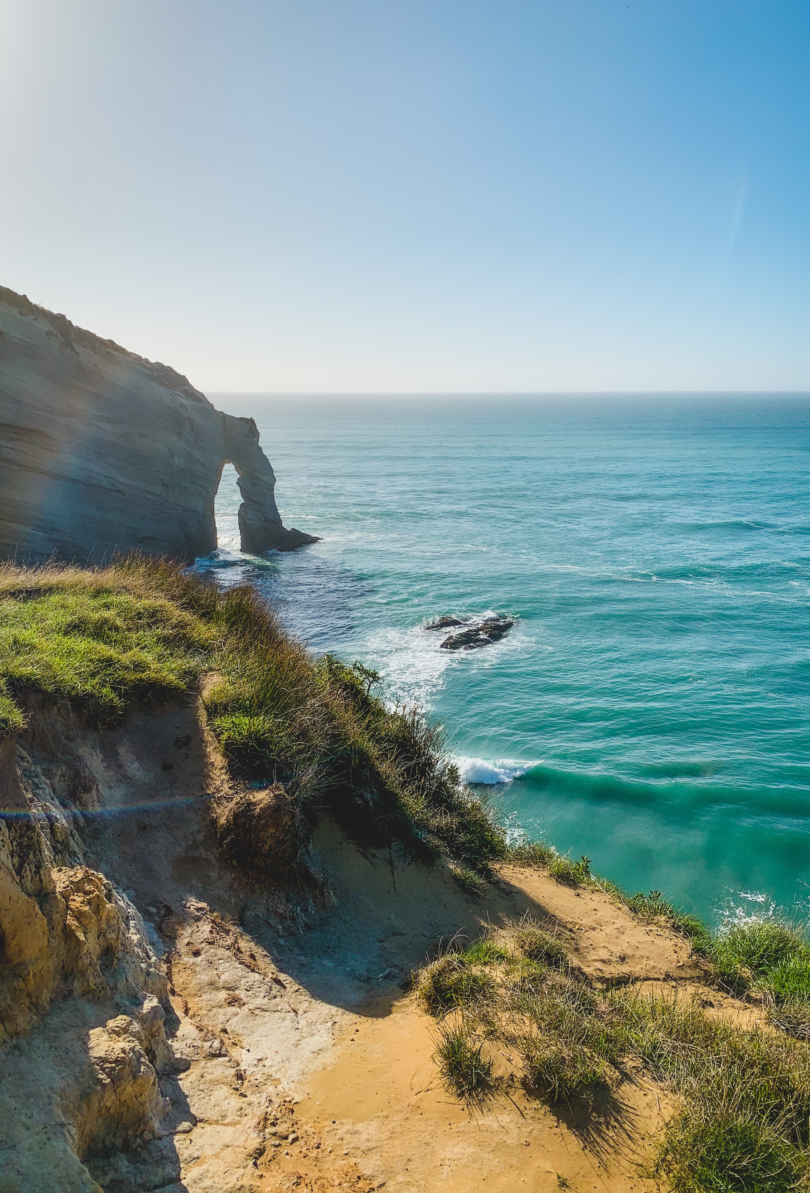
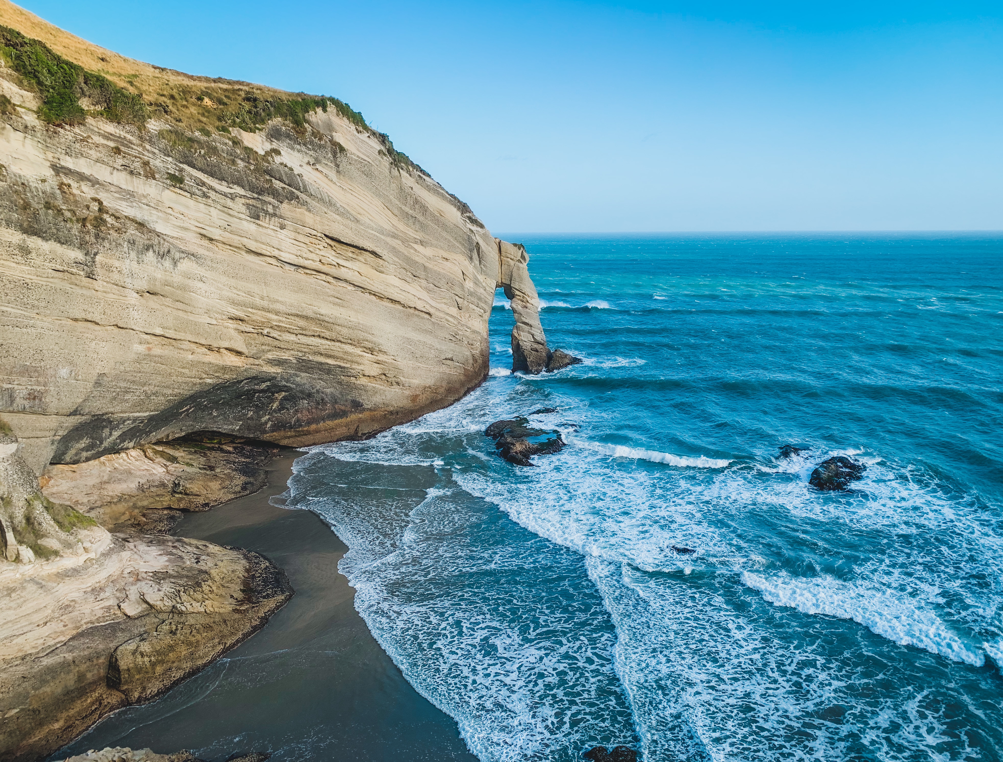
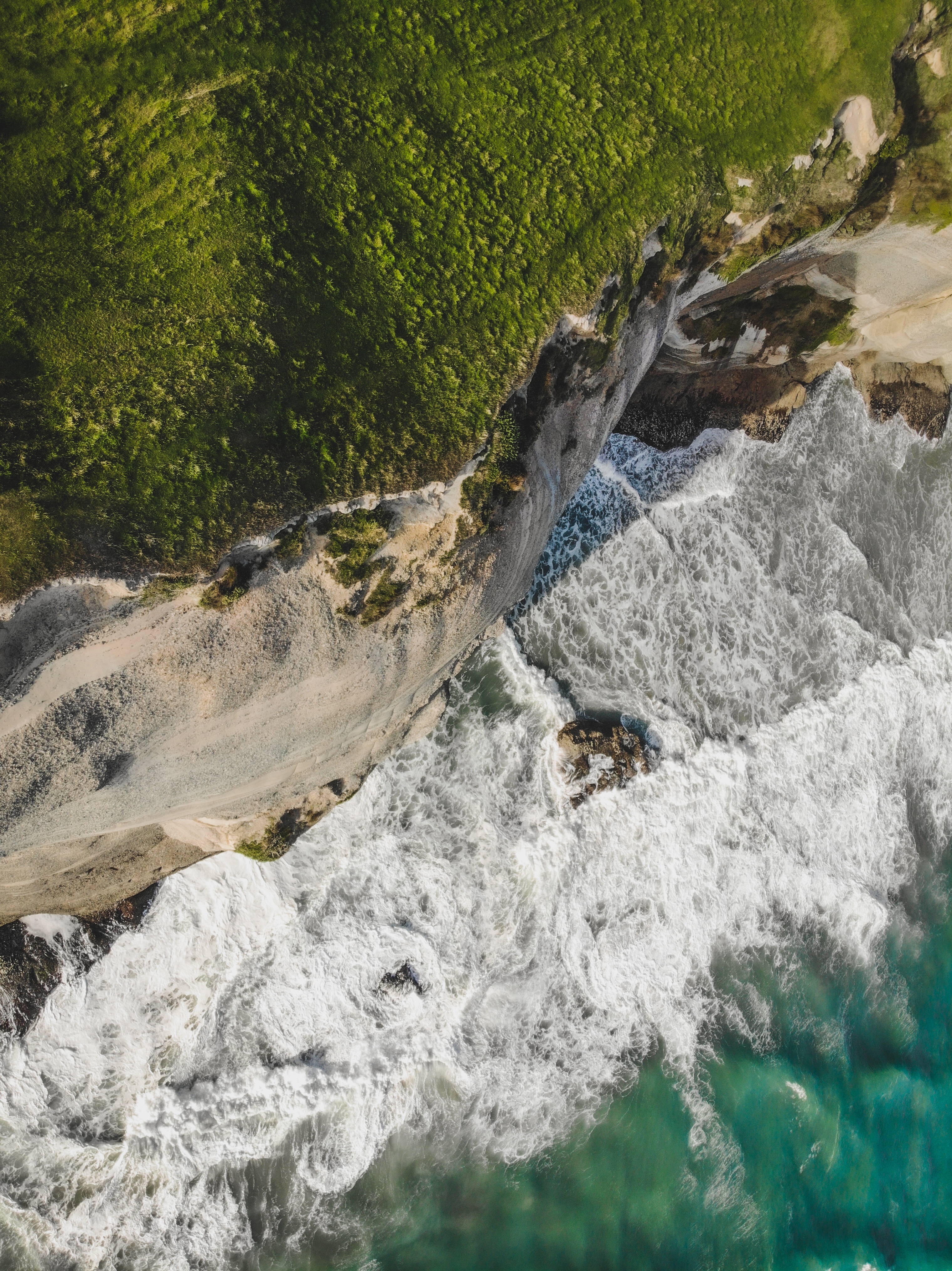
The first question I asked when researching Wharariki Beach was is it better to visit for sunrise or sunset (lighting-wise)? With no conclusive answer on the net, we opted for both and here are the results! First and foremost, your visit will be limited to the four hours of low tide which can be found online or at the Golden Bay Visitor Centre in Takaka. Secondly, calm conditions make for a much more pleasant visit as it can get very windy along this stretch of coast. The last thing you want is to be eating sand, or ruining your lenses with it! Luckily there are a variety of sea caves that you can explore and shelter in during low tide. We lucked out that low tide was happening during both sunrise and sunset hours.
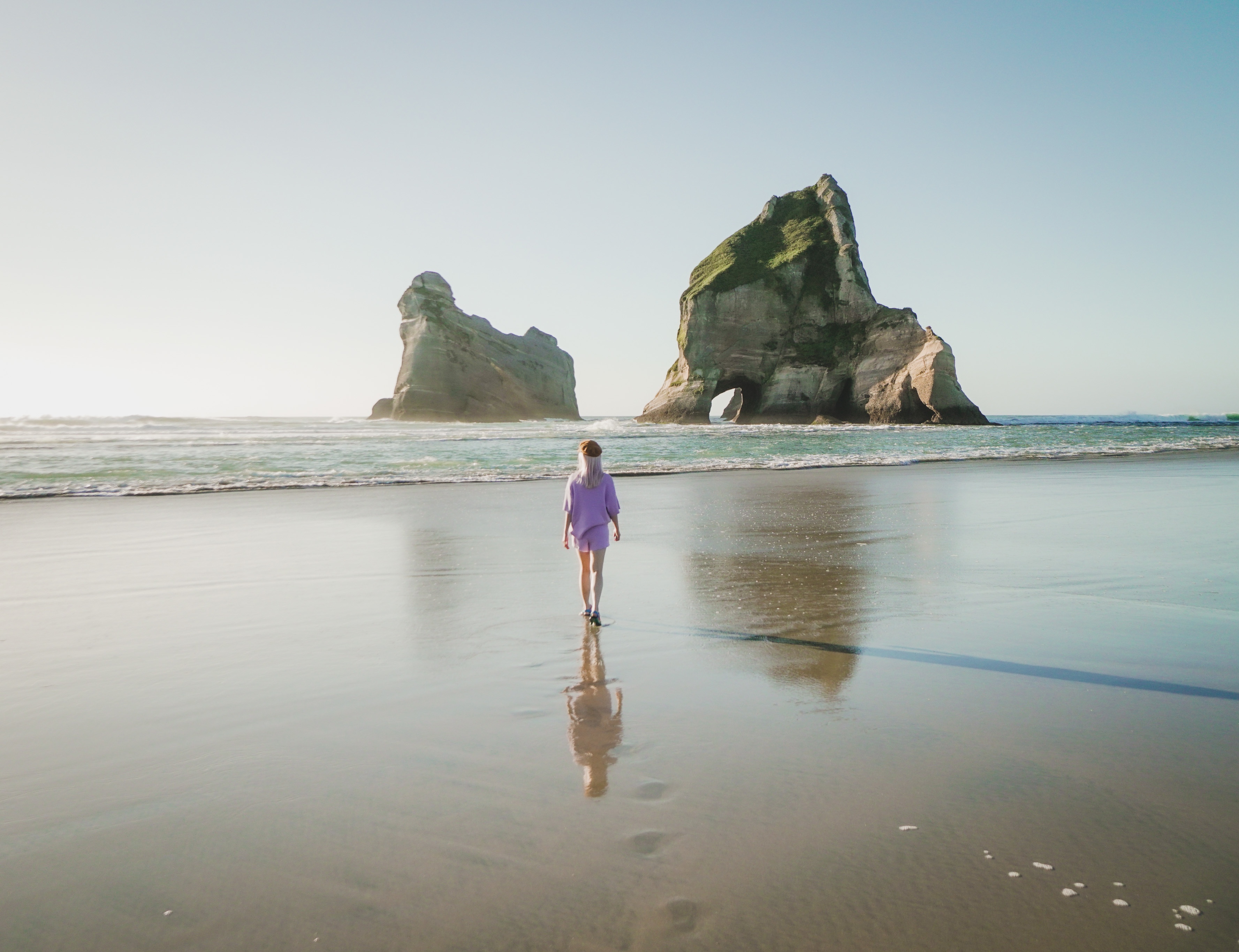
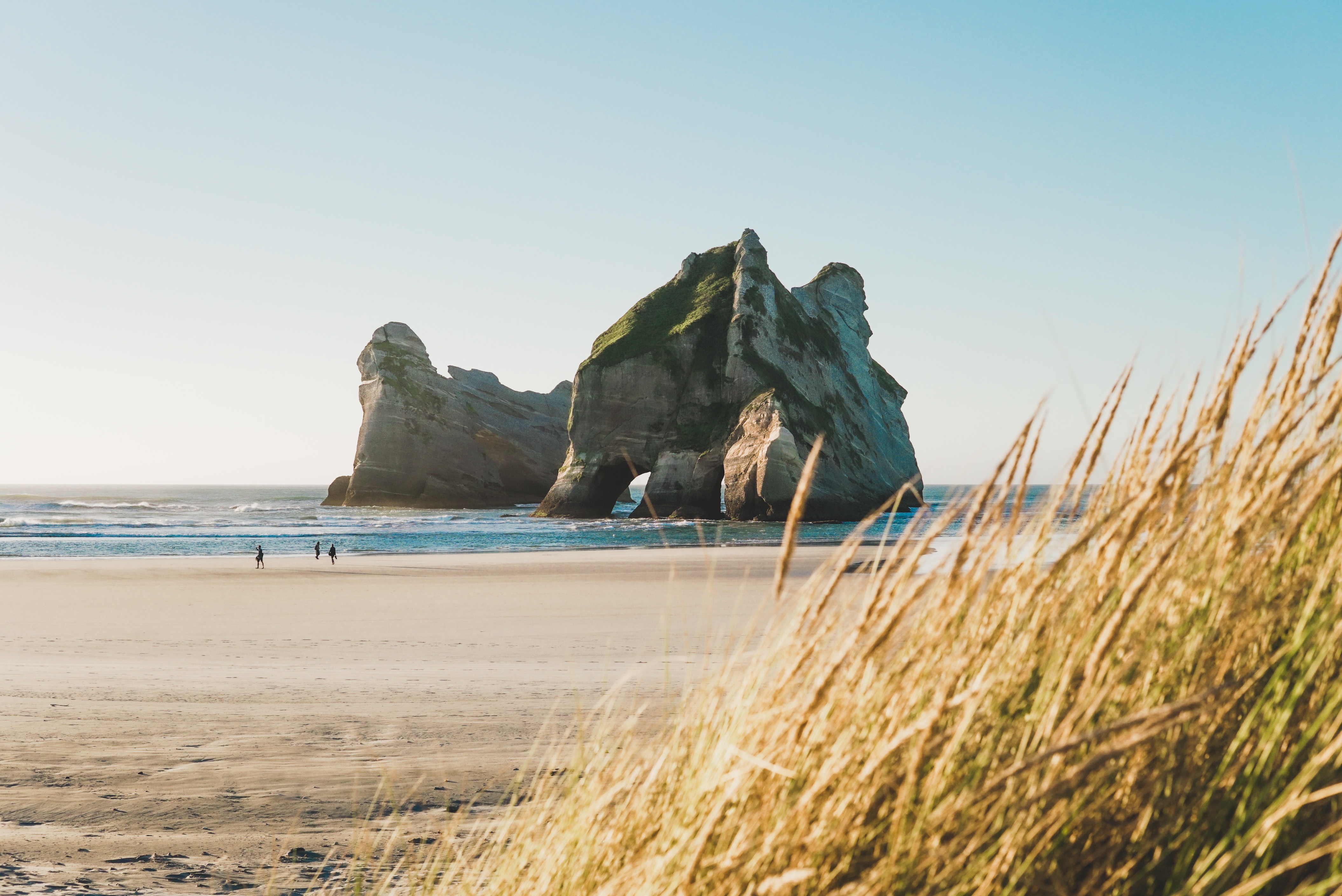
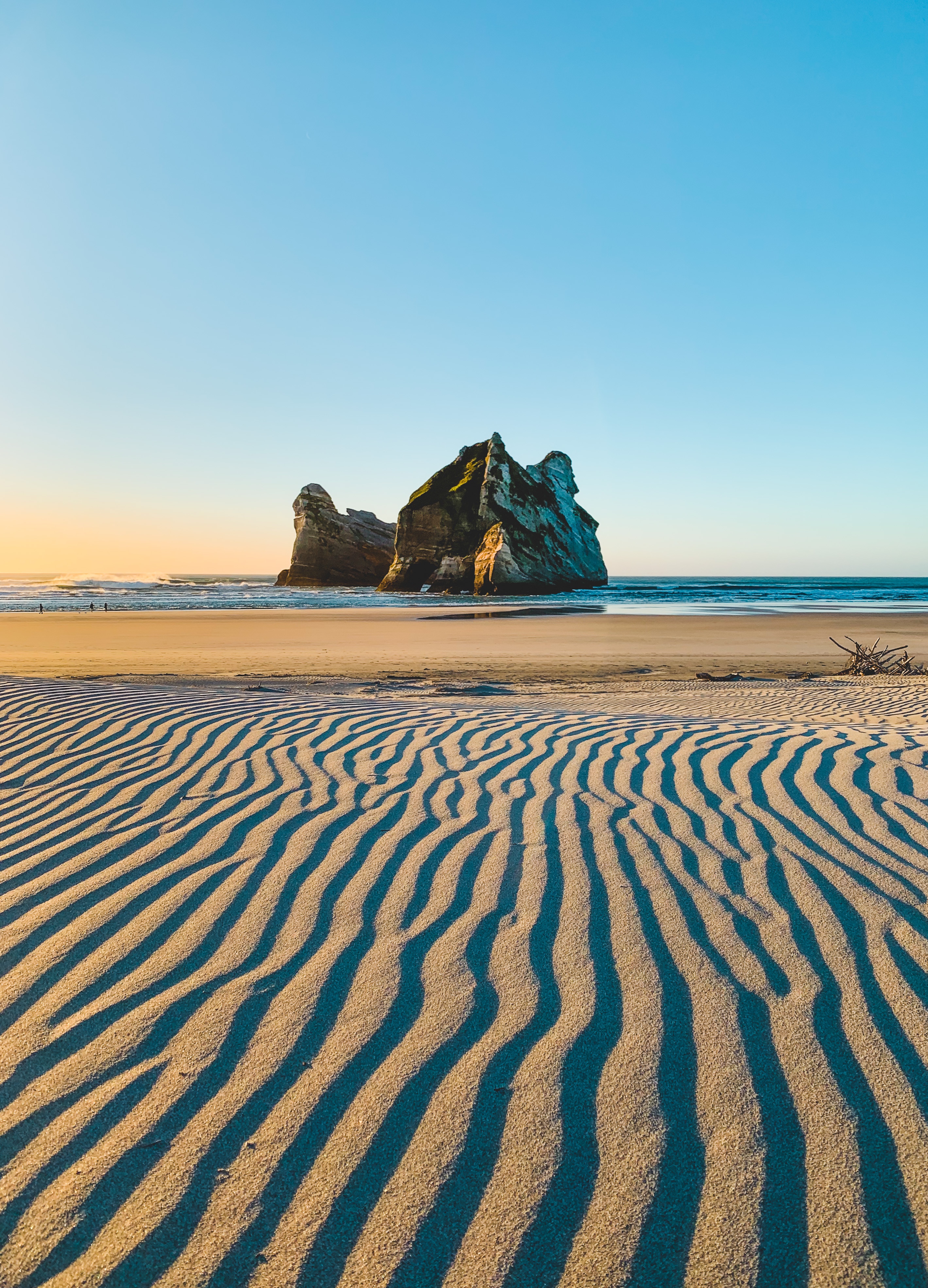
All the photos above were taken around sunset on a clear and calm evening. There were a handful of cars at the carpark, and less than 20 people on the beach during the couple of hours we were there. The afternoon sun lit up the caves and hills opposite the Archway Islands, as well as the islands’ west faces. The following morning, we returned to a blustery, semi-cloudy sunrise, bundled up and trying to keep warm as the wind worked against us. We caught a glimpse of what it could be like with finer conditions, with corridors of light streaking across the flat sand.

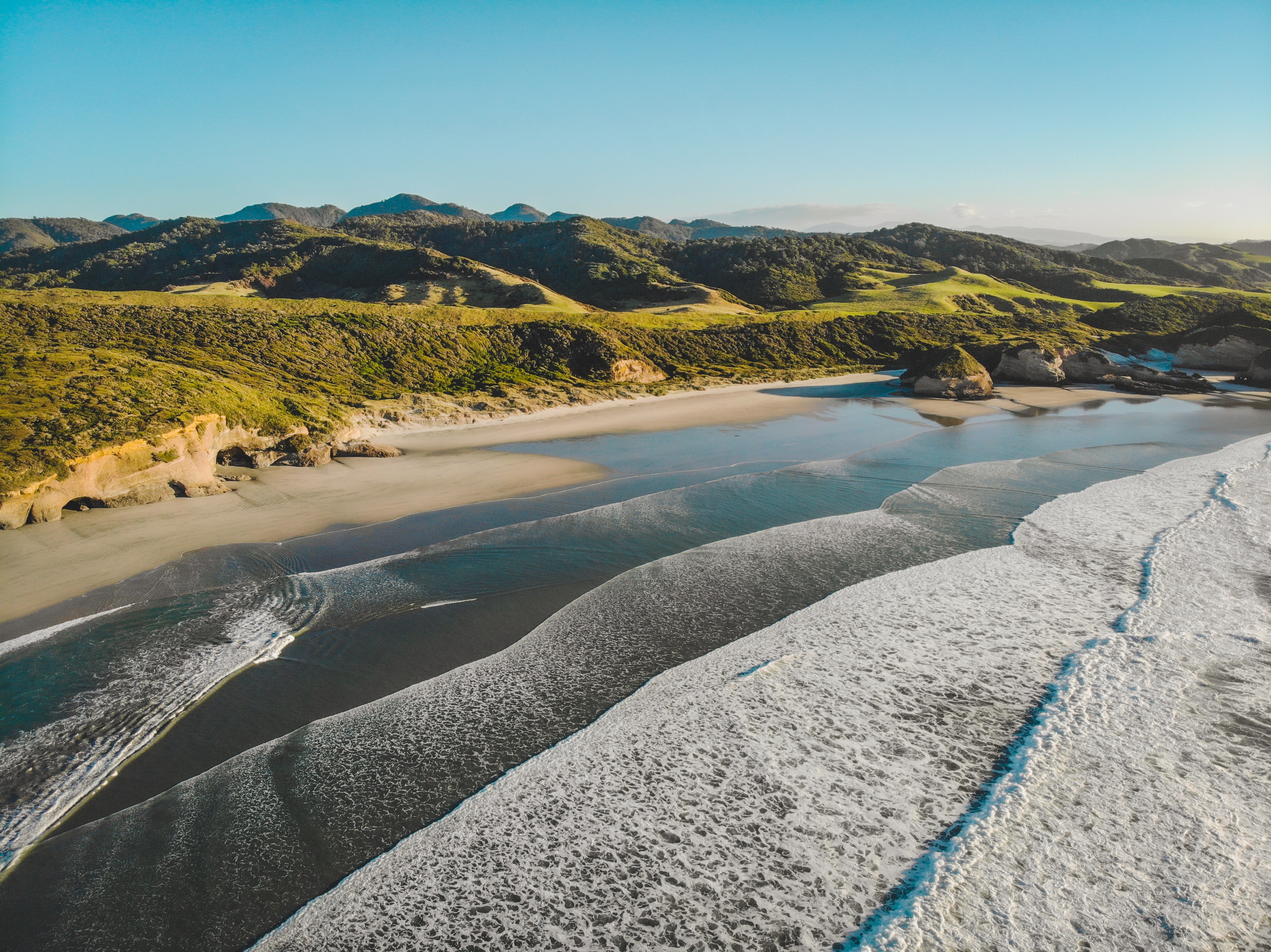
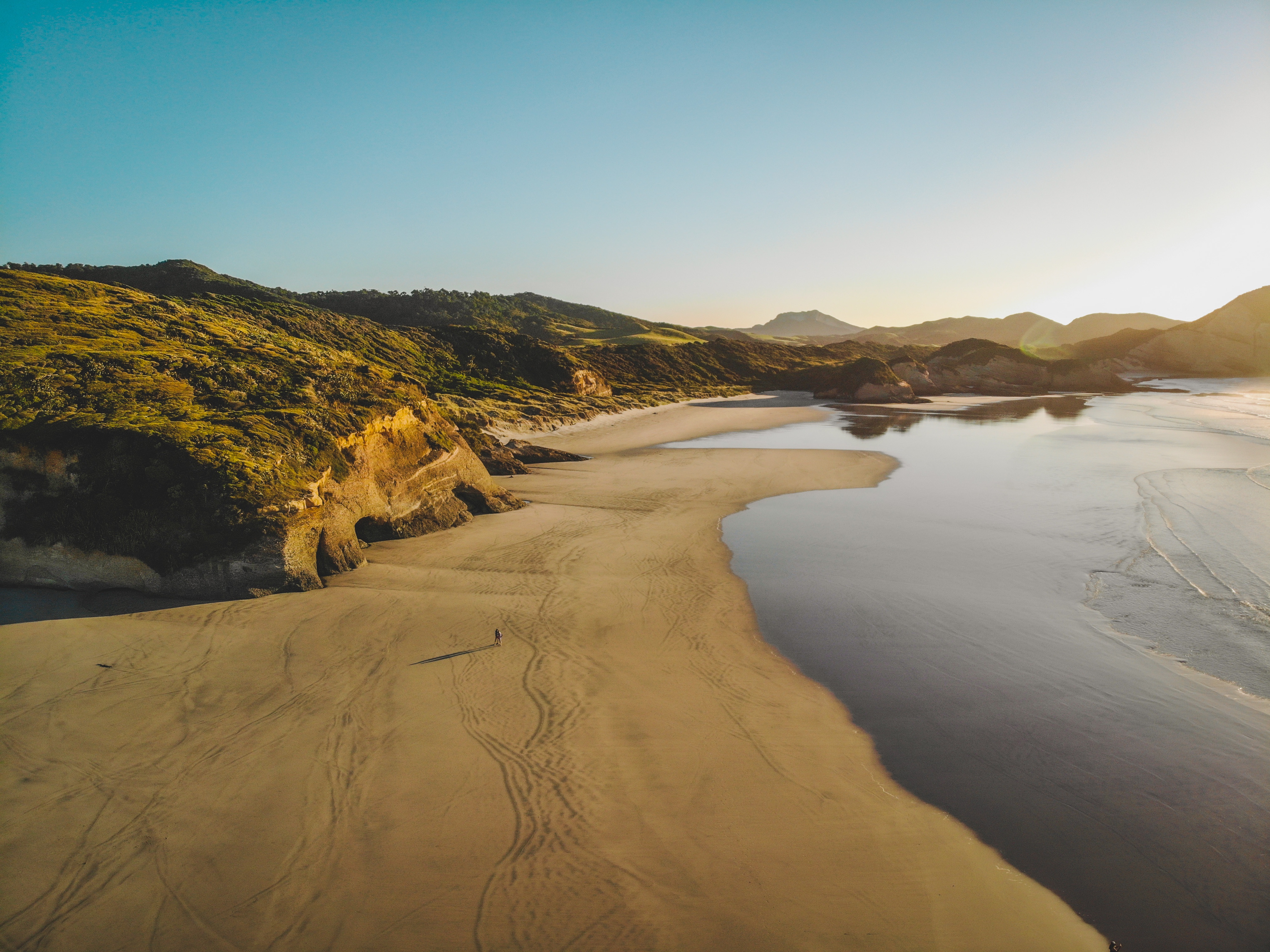
The Wharariki Beach carpark is a 2.5 hour drive from Nelson Airport, and a 50 minute drive from the smaller and closest Takaka Airport. The last section of the drive is on unsealed road, easily tackled with the average passenger car. The trail from the carpark to the beach crosses farmland and sand dunes, and is a very enjoyable 15-20 minute walk.
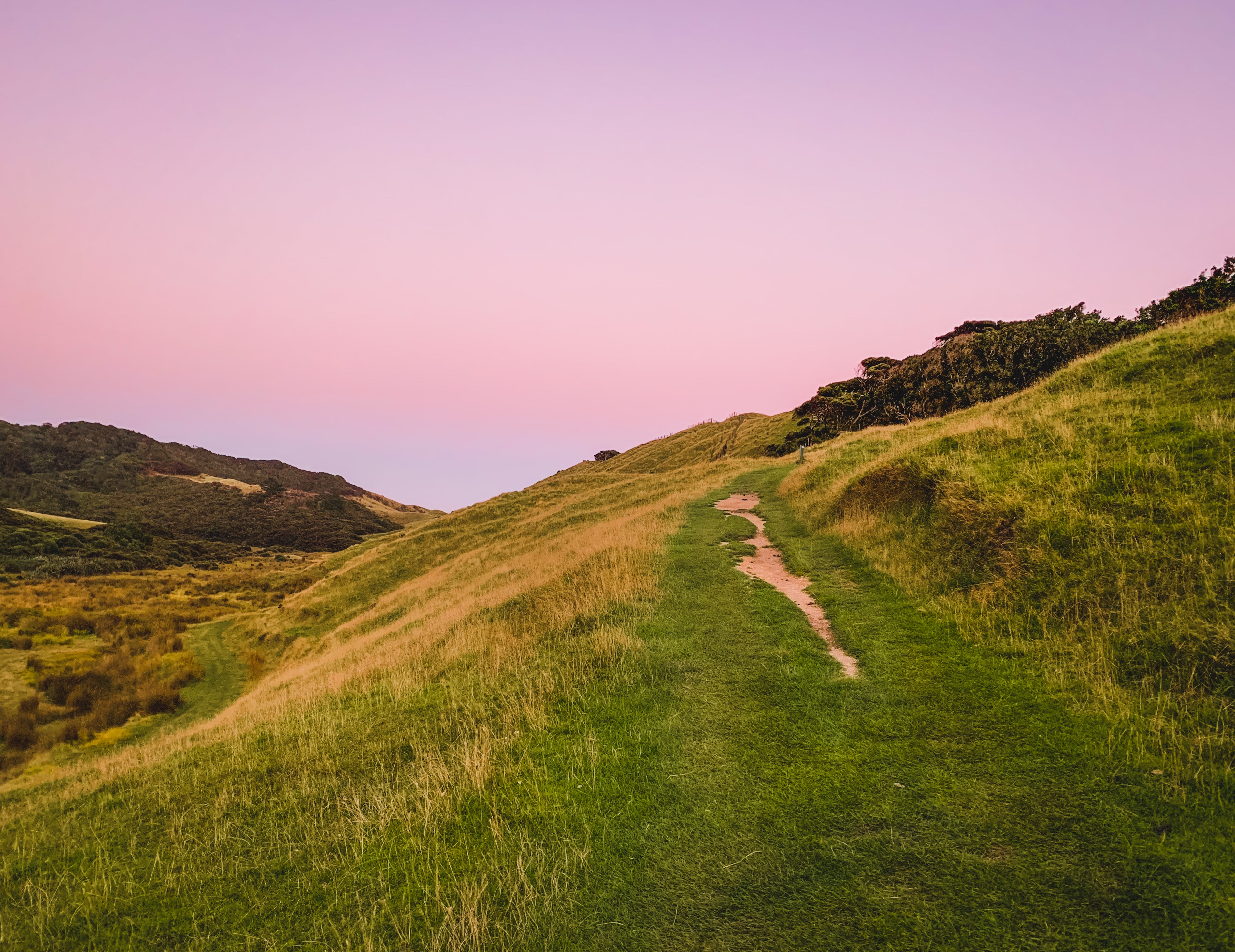
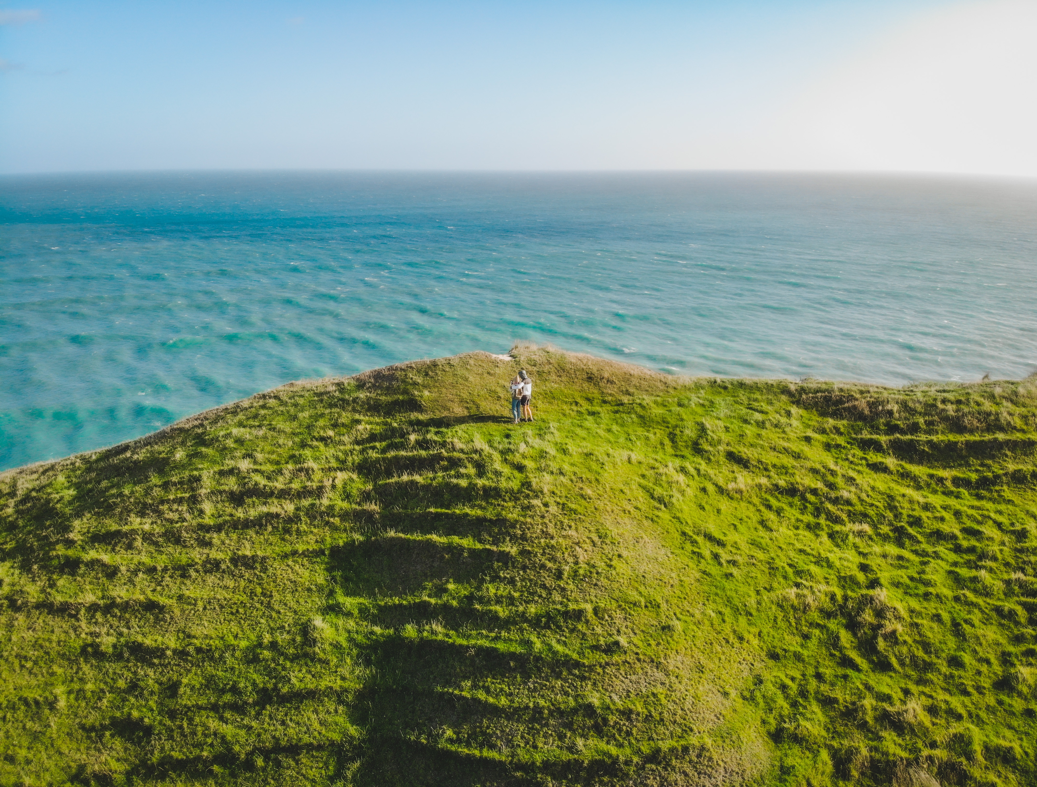
Since we were a bit cold and impatient to wait for the sun to make a full appearance, we headed to our next destination, Cape Farewell. Having stopped by this incredible lookout spot the afternoon before, I can safely say it is much better to visit when there is as little wind as possible. At 3 hours before sunset, the afternoon sun sits behind the famed arch, whilst lighting up the rolling hills over which you can traverse a section of the Puponga Hill Top Track. This track begins at the Puponga Farm Park Visitor Centre and ends at Wharariki Beach, totalling 18km. It climbs along Old Man Range to Pillar Point, then Cape Farewell and Wharariki Beach, showcasing the expansive views.
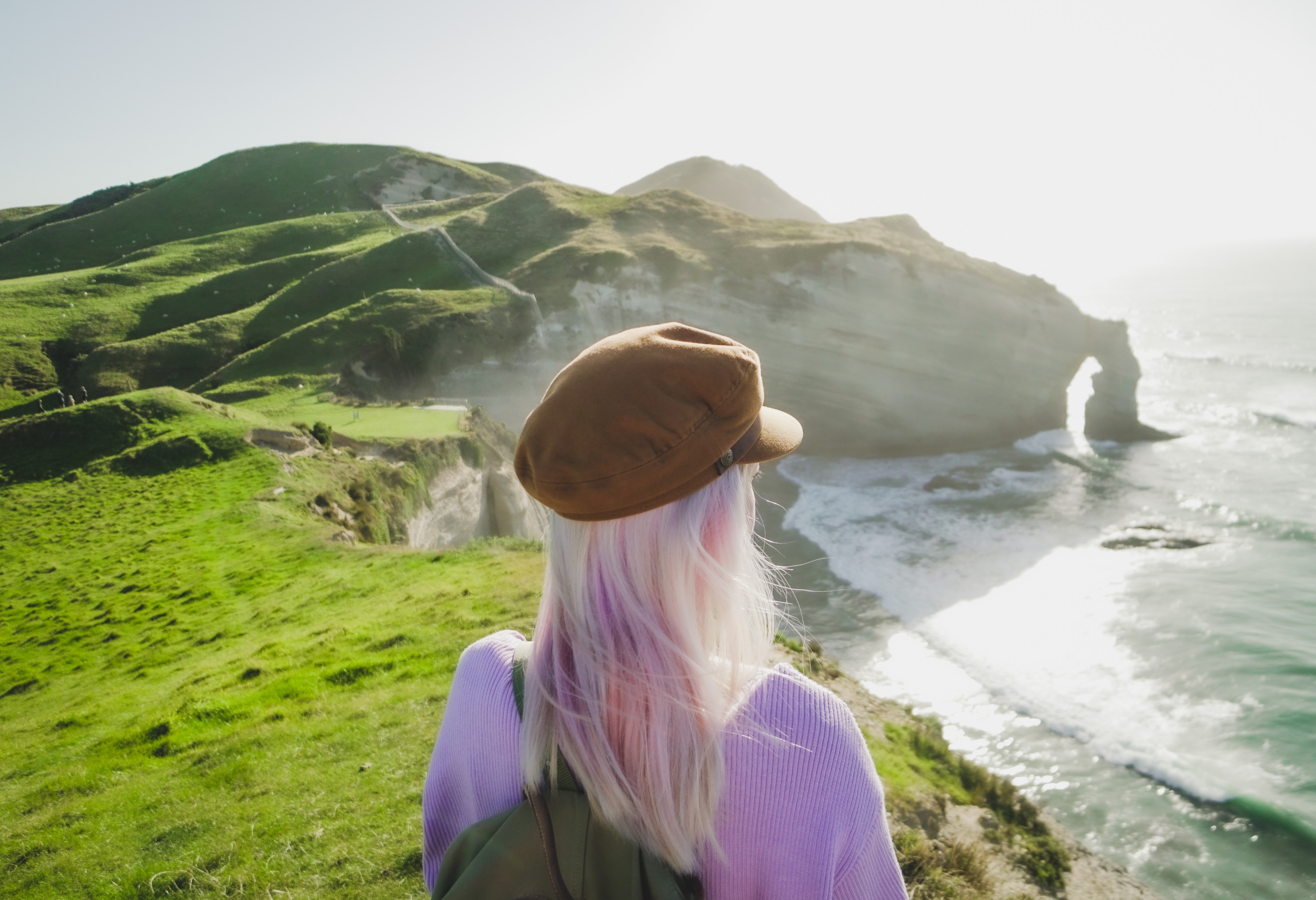
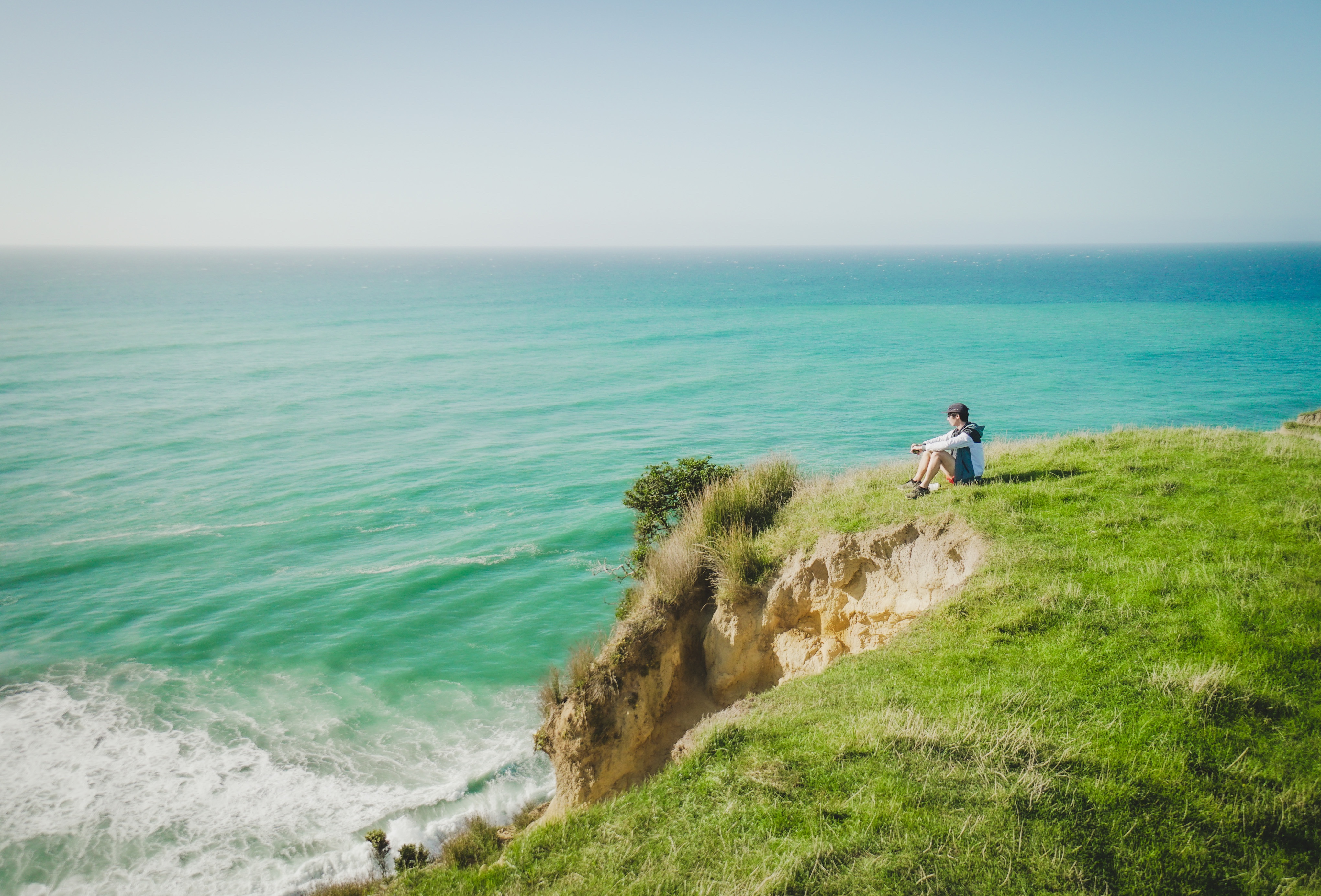
The right turn off to Cape Farewell along the unsealed Wharariki Road goes through two farm gates before reaching the carpark. From there it is a short 5 minute walk to the viewing platform, but you can go as far as you want along the Hill Hop Track for the best vantage points. The photos below show the cape bathed in morning light, but we didn’t hang around for long since the gusts of wind at the cliffs edge were enough to make me quiver!
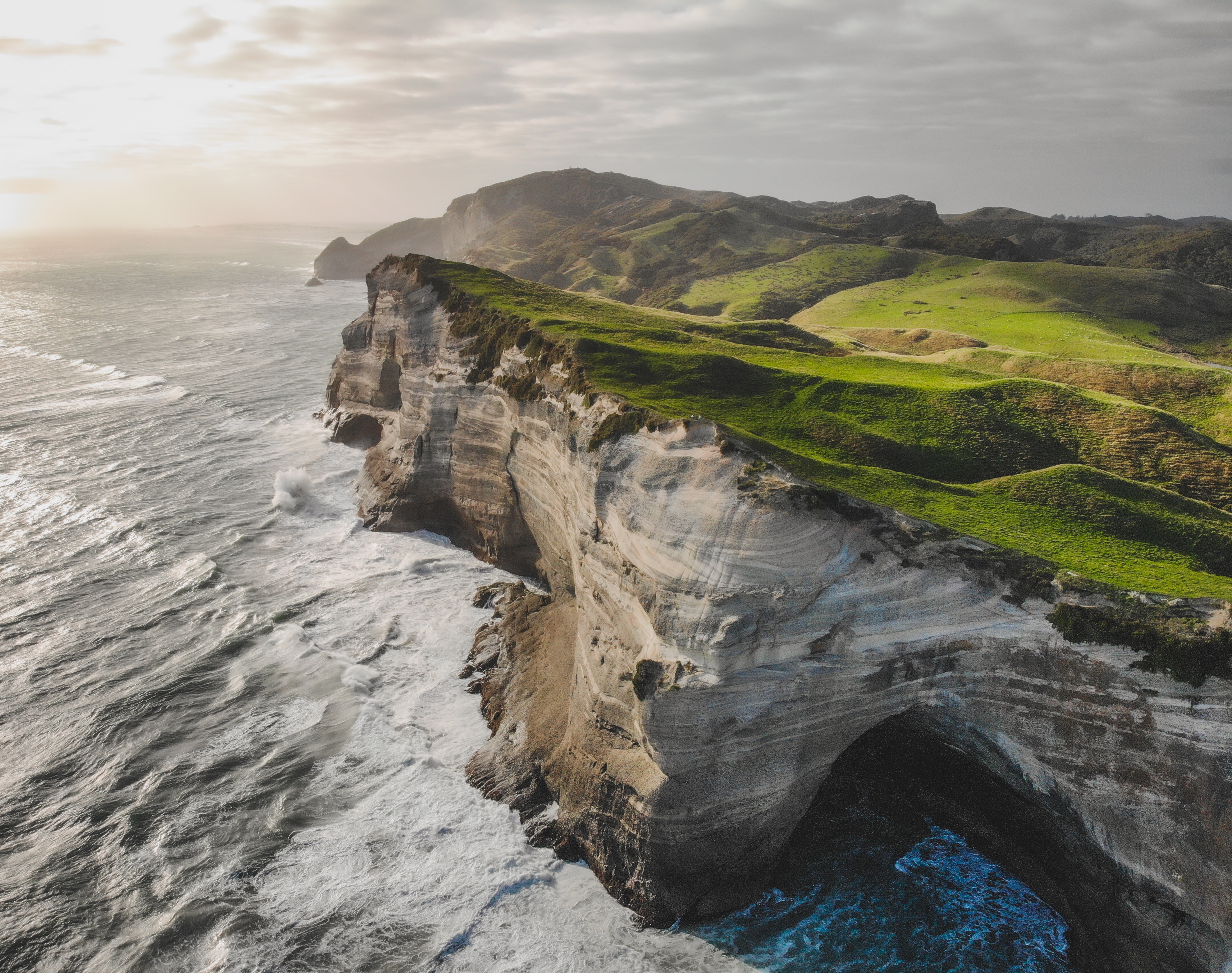
For those who are short on time, or the prospect of hiking 18km does not entice you, there is a shorter track from Wharariki Road up to Pillar Point Lighthouse and beyond that will give you views of Farewell Spit in the distance. It took us 30 minutes from the small carpark/pull-out to reach the plateau that offers views of Old Man Range and Farewell Spit, and all along the way, you can look back at Wharariki Beach, Cape Farewell and the Hill Top Track winding its way through farmland.
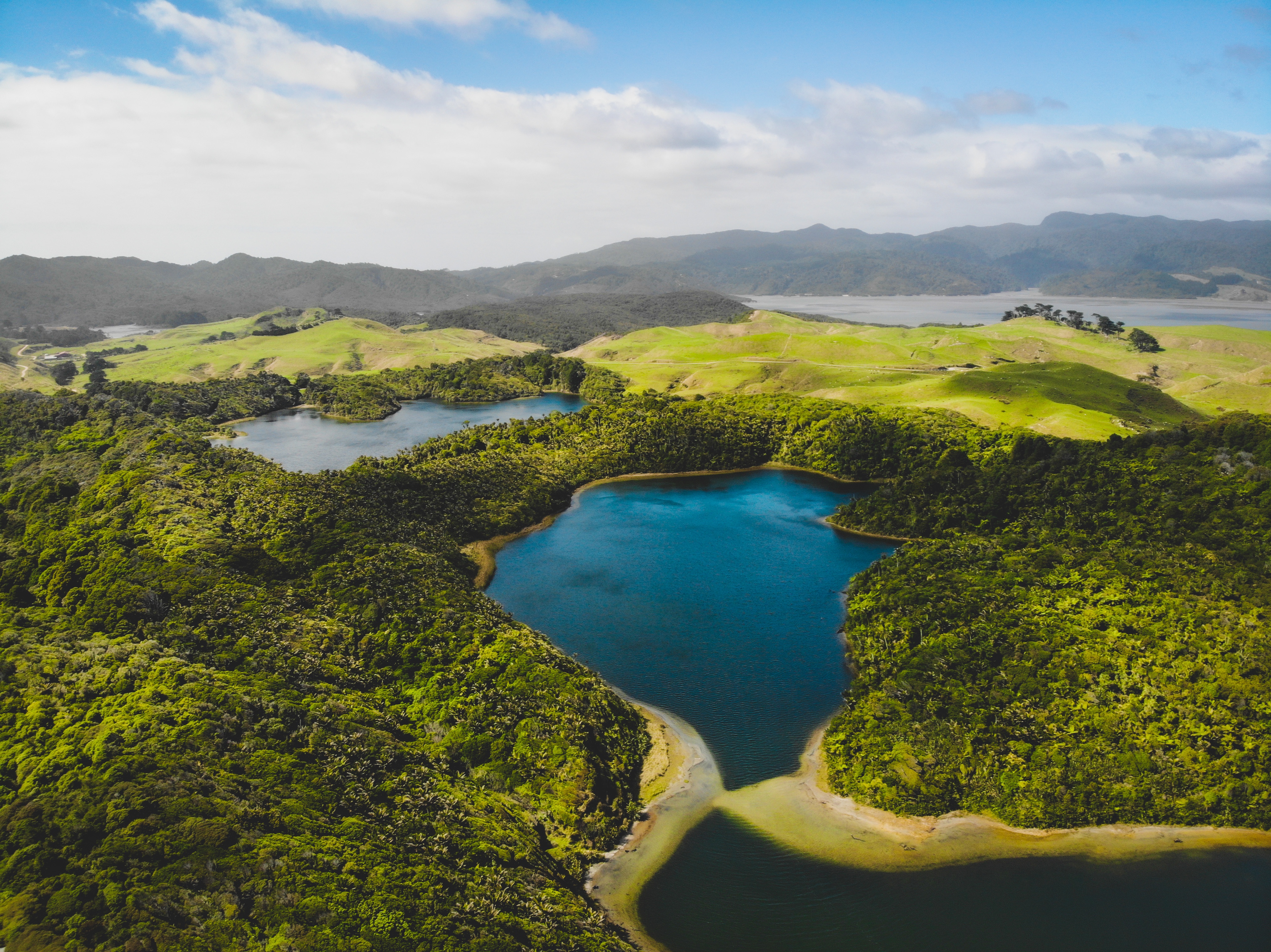
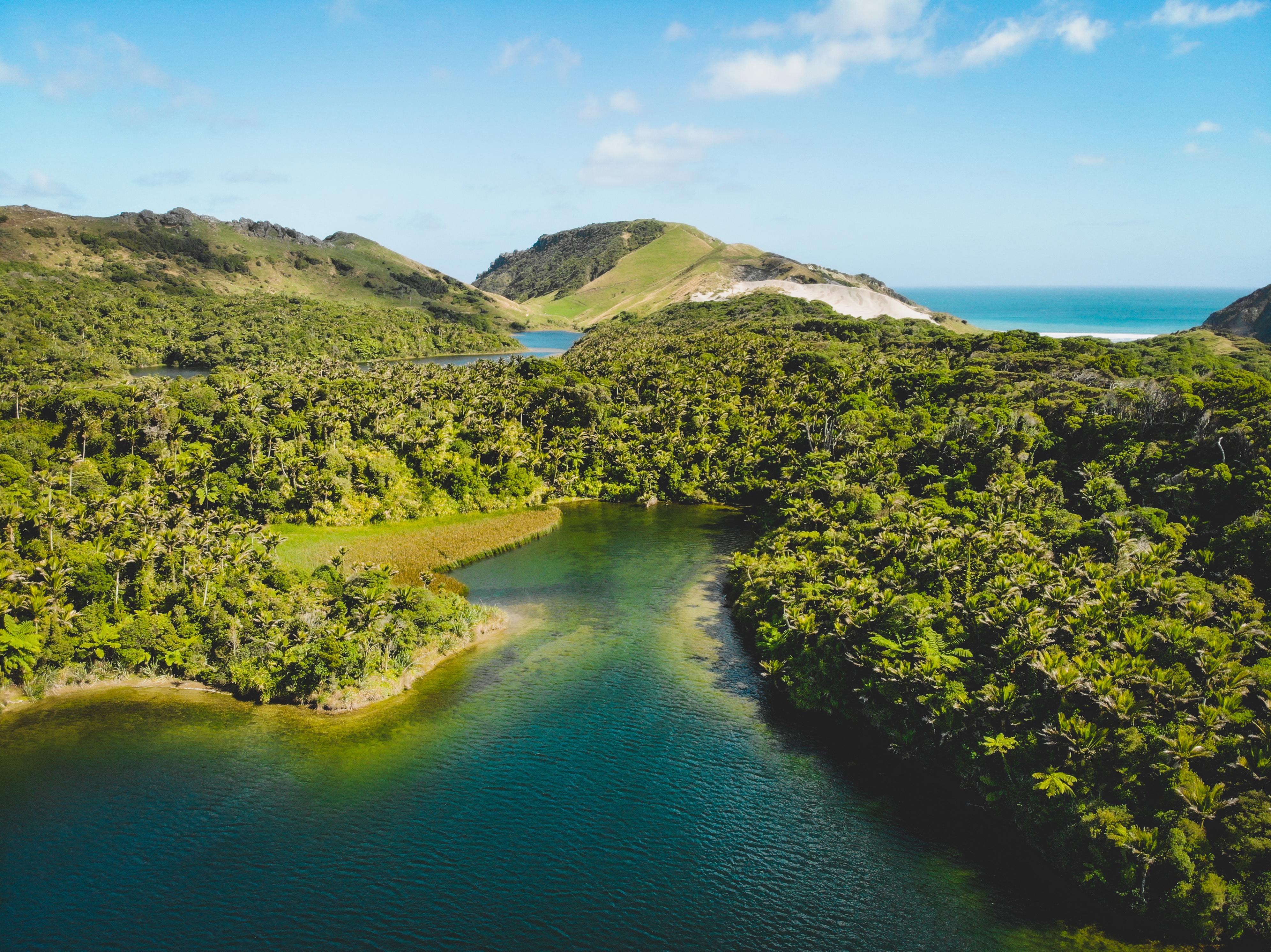
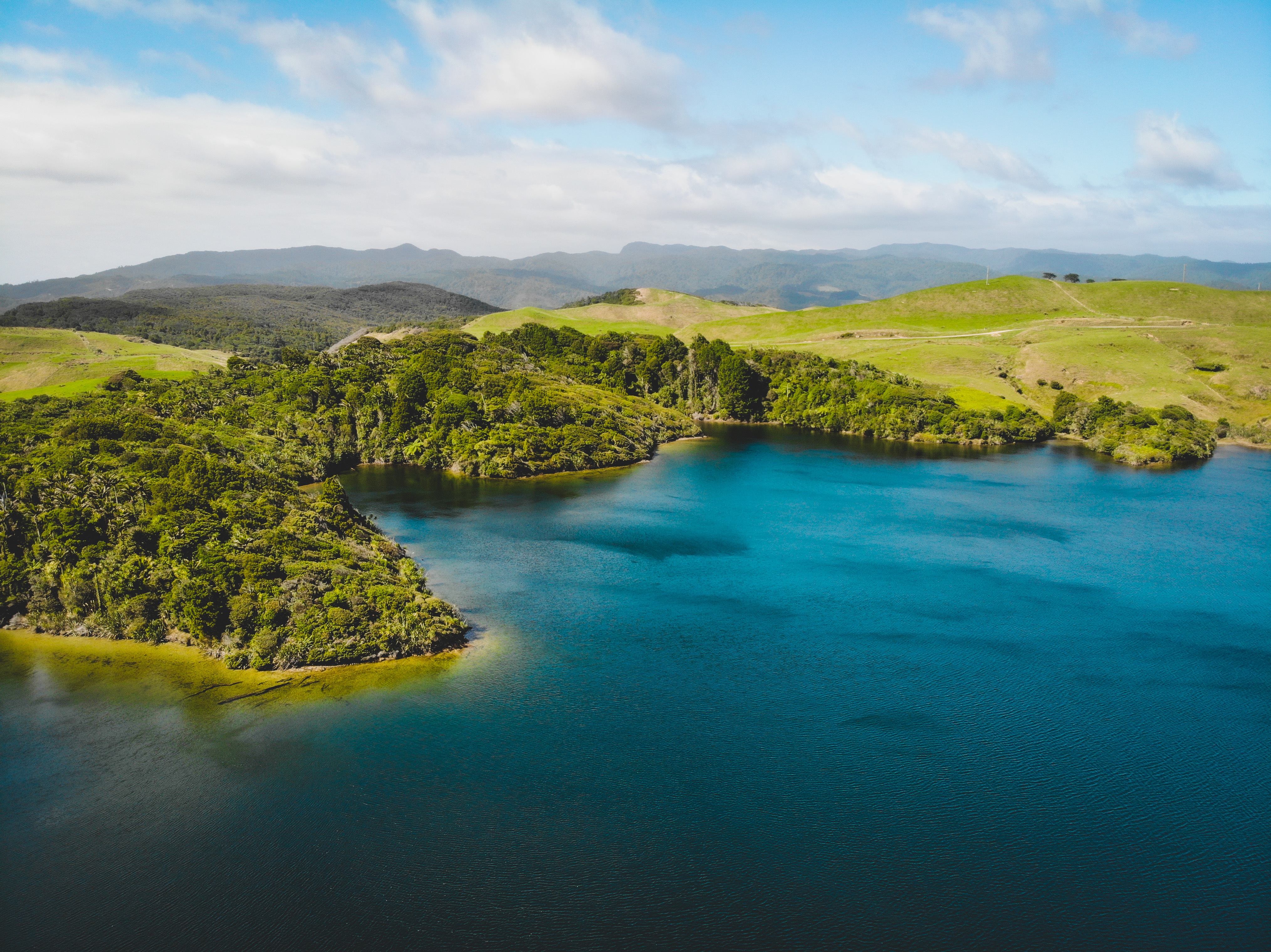
As you head south along the Collingwood-Puponga Main Road, a detour to the right will take you along Pakawau Bush Road to the Westhaven (Whanganui Inlet) area. We continued right onto the unsealed Kaihoka Lakes Road and parked up at Kaihoka Lakes, from which there is a 10 minute one way track you can walk from one lake to the other. The lake would be perfect for a kayak or swim in the summer, and if you can find it, there is a walking track that will take you to the elusive sand dunes and Kaihoka Beach, dotted with palm trees. There are a handful of farmstays and lodges in the Westhaven area, otherwise the lake carpark is a 30 minute drive from Collingwood.

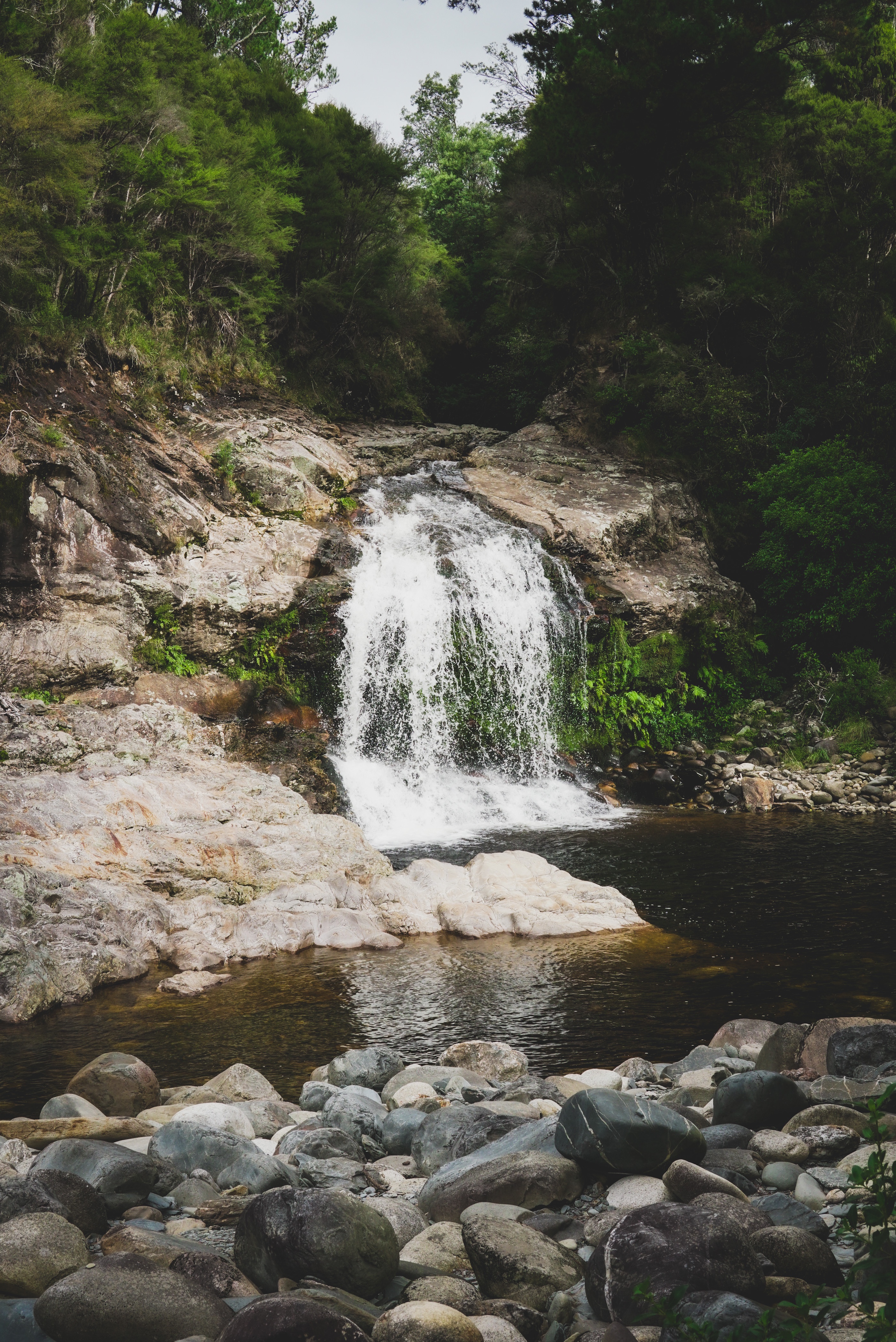
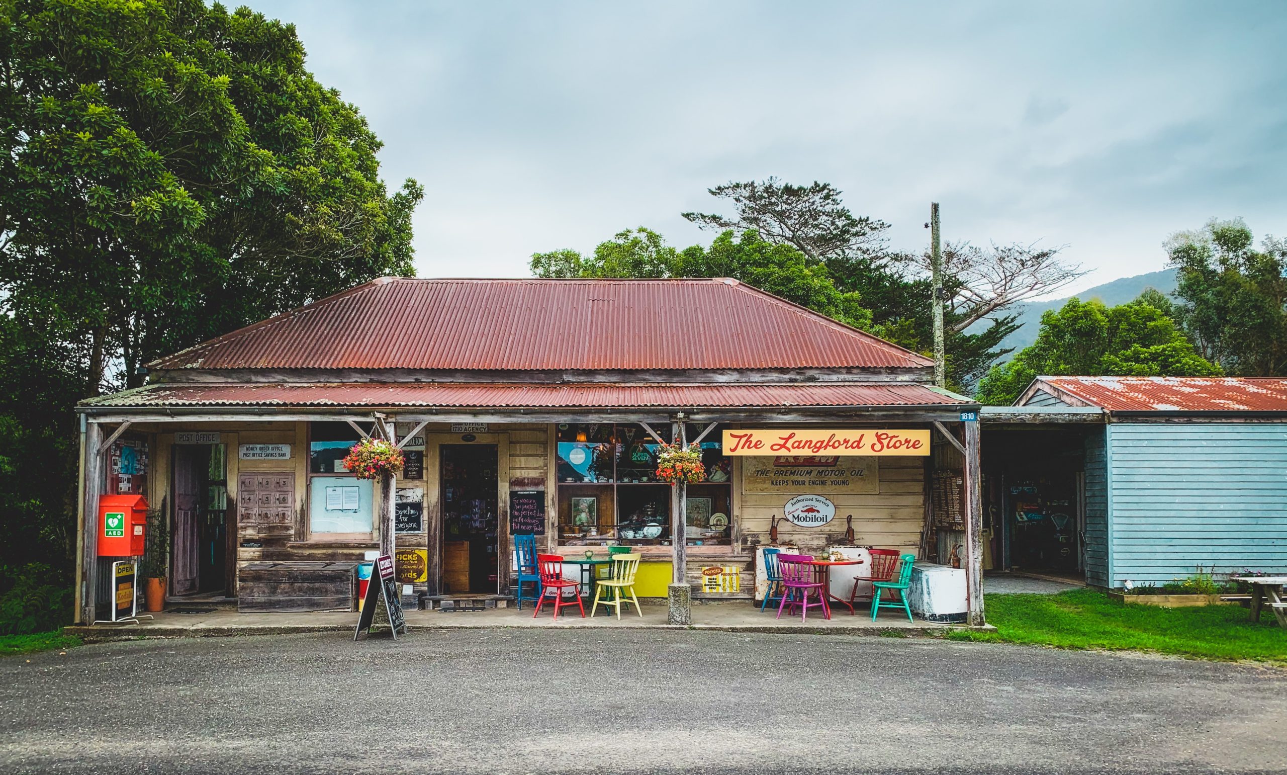
Collingwood was a great base for us to explore the tip of the south island, being a 30 minute drive from Wharariki Beach. We stayed at an Airbnb for 2 nights, had good meals at The Courthouse Cafe and Mussel Inn (the latter a 10 minute drive south), and wandered around this little seaside village perched at the edge of the Ruataniwha Inlet. There is a quick walk to a lookout from Orion Street, and our host also pointed us southwest to The Langford Store in Bainham and Salisbury Falls (mind the sandflies). There are collectable antiques, artwork, and tea and coffee on offer at the Langford Store, and this gal had her own Desperate Housewives moment and picked up a hand-made kiwiana apron as a souvenir. The lady at the counter was kind enough to alter the neck strap for me then and there which is a bonus for the shorties out there! If you continue down the Aorere Valley Road, it will take you to the end (or start) point of the Heaphy Track, one of New Zealand’s multi-day Great Walks.
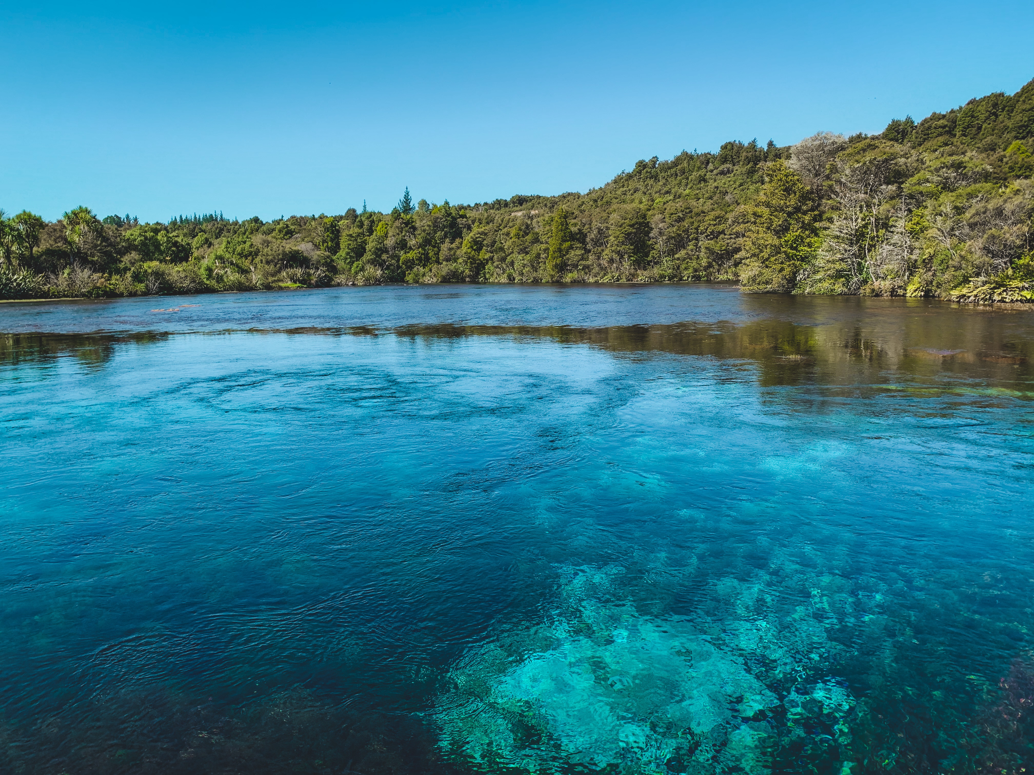
Heading south to Takaka, make sure you stop by Te Waikoropupu Springs for an easy stroll through the freshwater spring, and further east to Ligar Bay and Tata Beach. This part of Golden Bay borders the north end of the Abel Tasman National Park, and features the iconic golden sand beaches. There are some great views from the Abel Tasman Monument overlooking Ligar Bay and Port Tarakohe, and we thoroughly enjoyed our lunch at The Wholemeal Cafe in town.
As you make your way over the Takaka Hill, there are plenty of opportunities to stop at various lookouts/trails, one of which I didn’t discover until I was back home – the Riwaka Resurgence. I’ll be sure to pay a visit to this swimming hole one future summer as the water looks oh so clear! Other stops include the Takaka Hill Walking Track, Ngarua Caves feat. stalactites, and Hawkes Lookout.
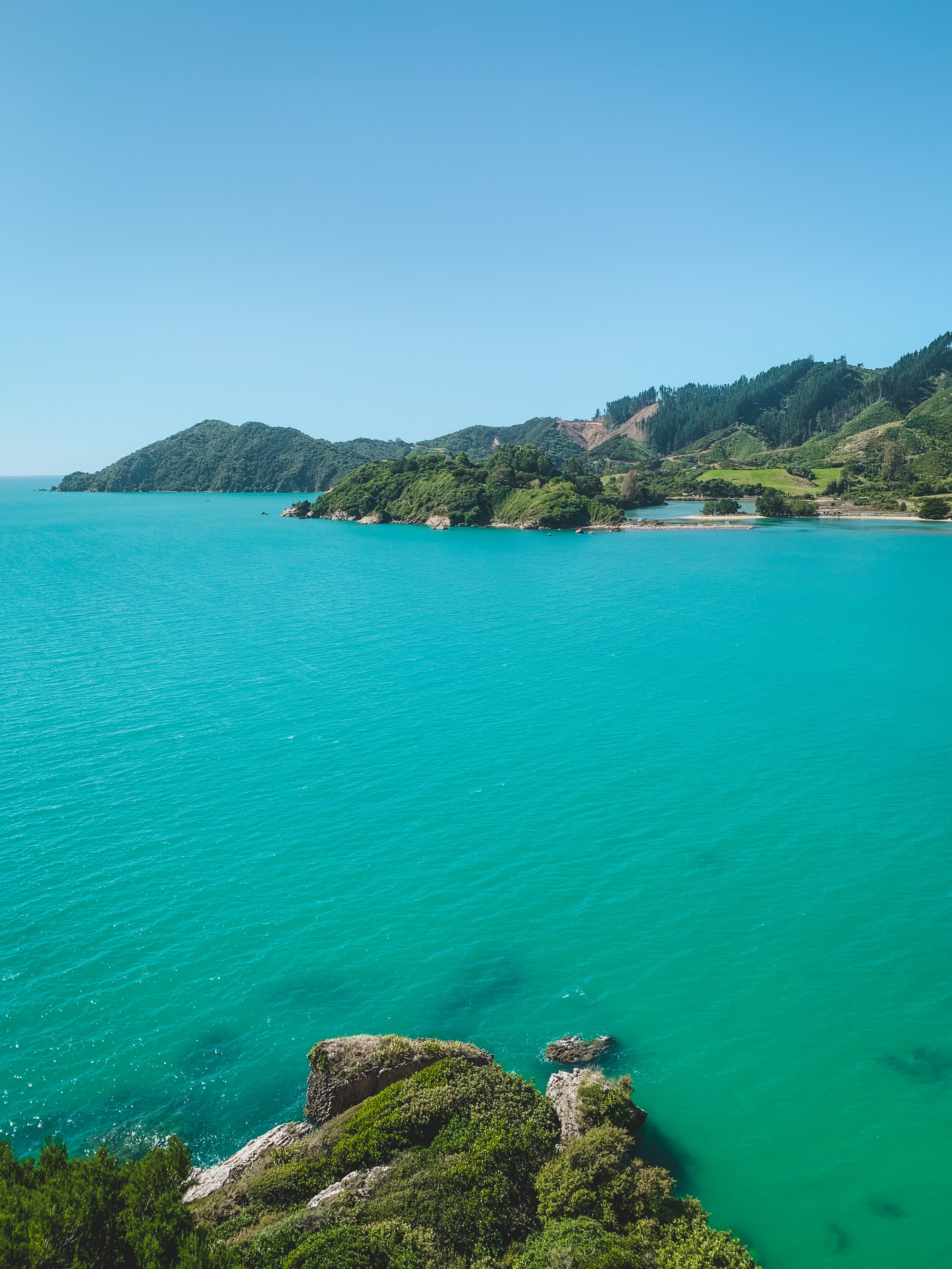
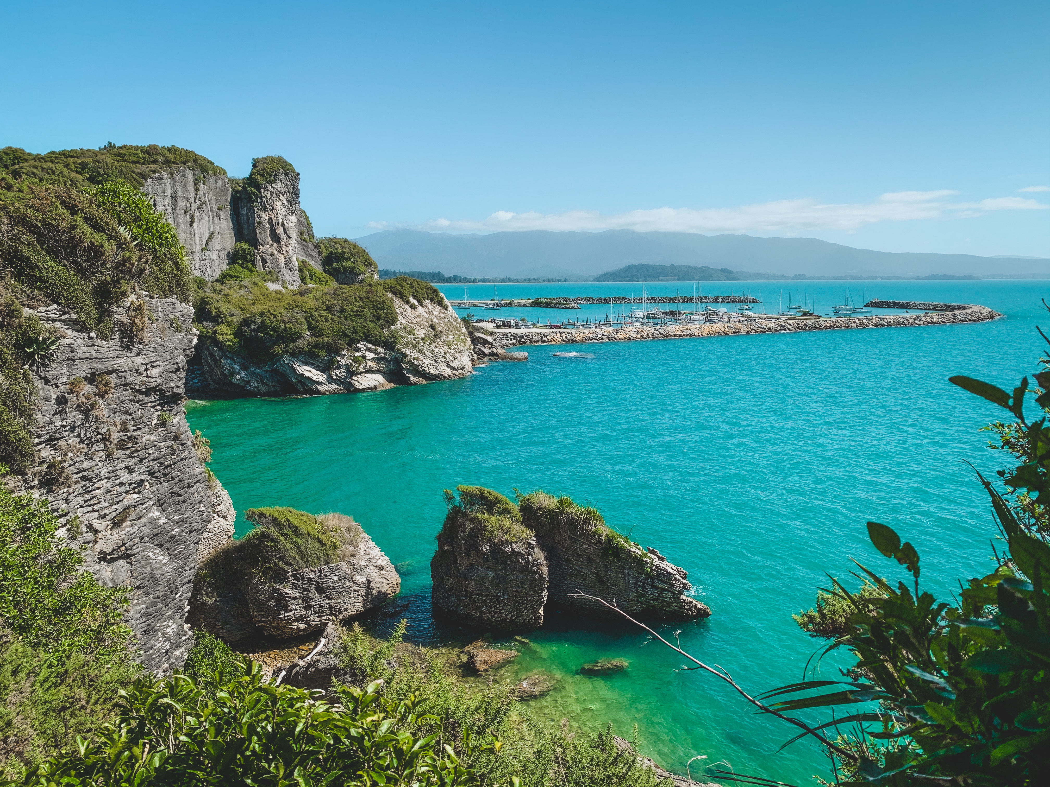
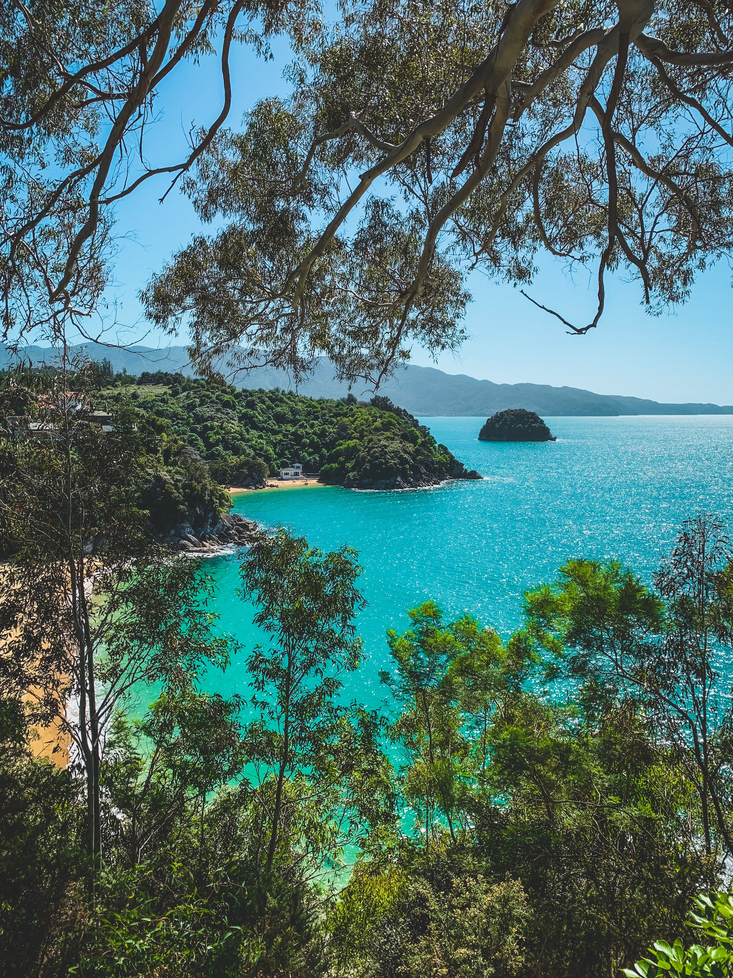
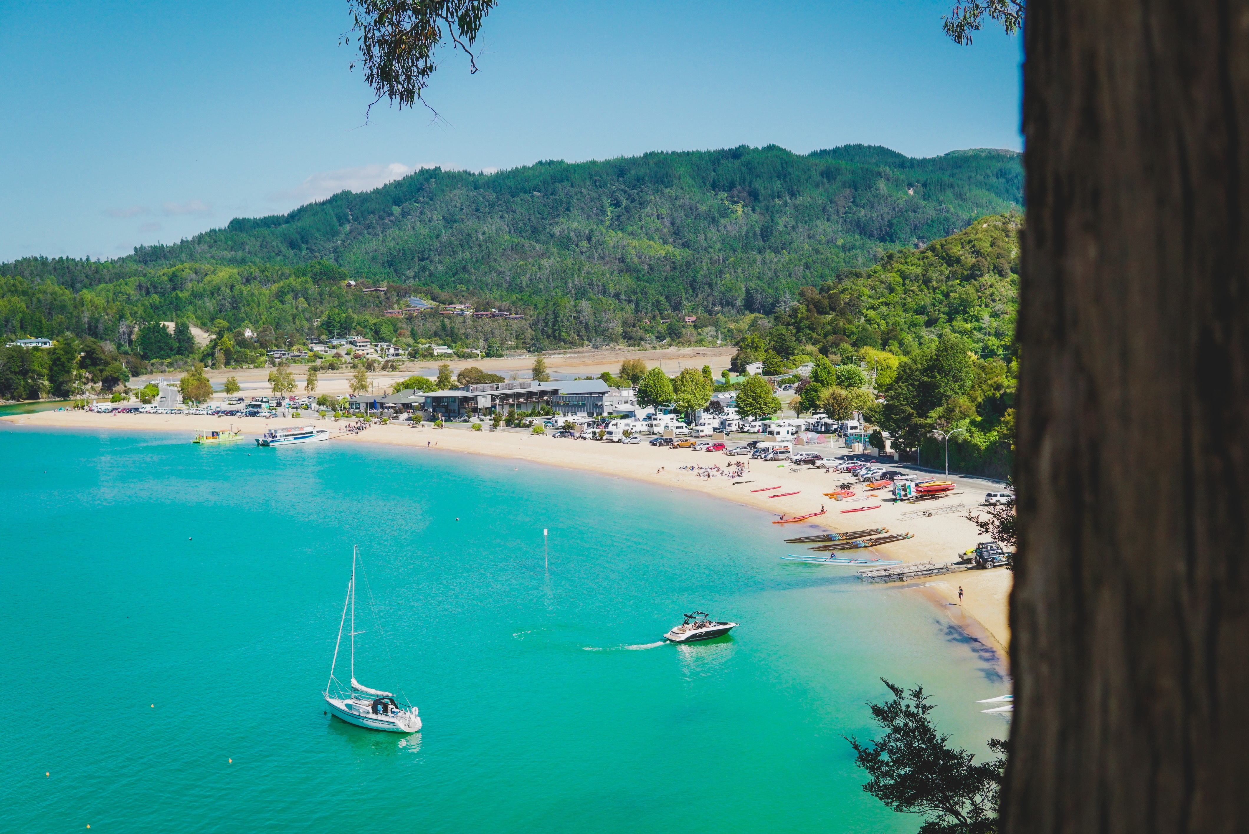
At the southern end of the Abel Tasman lies the glorious beachside towns Kaiteriteri and Little Kaiteriteri, a place that conjures up hilarious memories from our pre and post graduation days. We were treated to bluebird conditions as we drove past this time, and eagerly went on a coastal walk to soak in the brilliant blues and golden hues from Little Kaiteriteri to Stephens Bay. Starting from the Rowling Road carpark, the trail curves up and around the rocky coastline, offering panoramic views the entire way.
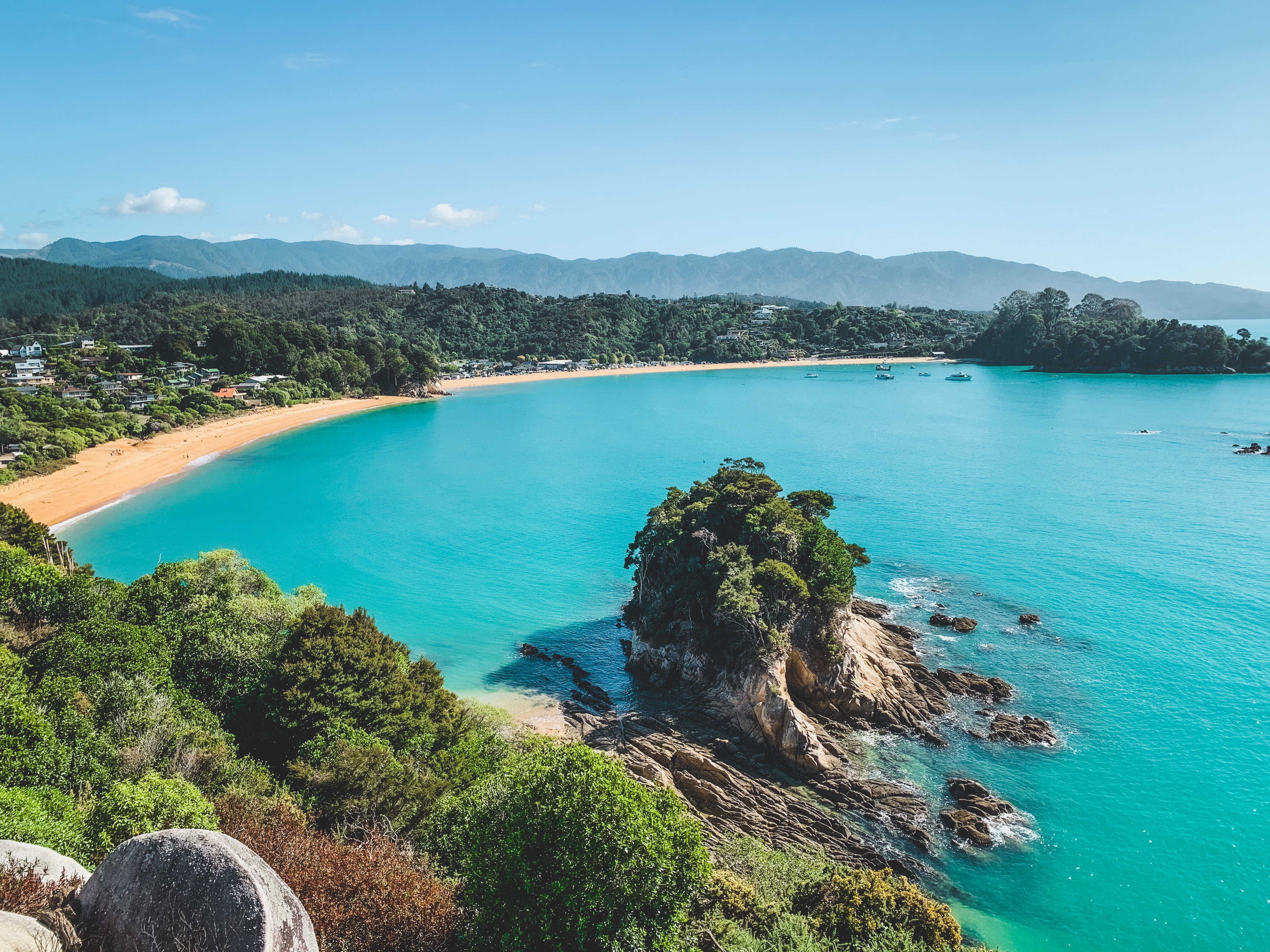
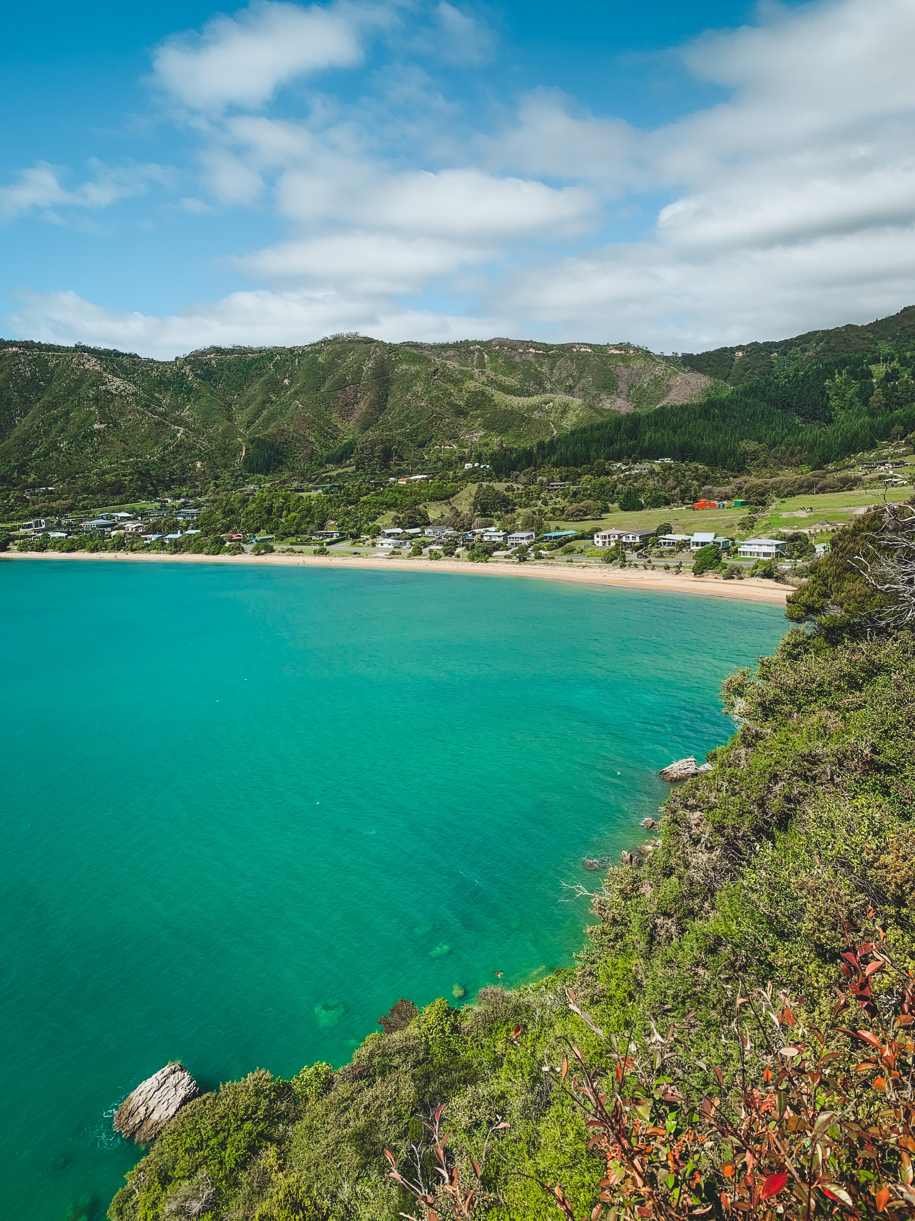
After a quick bite to eat at Kai Restaurant & Bar on Kaiteriteri Beach, we wandered north up Kaiteriteri-Sandy Bay Road and turned right towards the Kākā Pah Point Historic Reserve for elevated views over the main beach on the south side, Kaka Island to the east, and Breaker Bay to the north. Kaiteriteri can get very busy and over run with tourists during peak season, so a visit in March was perfect, and still warm enough for some to take a dip at the beaches. There are plenty of secluded little beaches and bays all around the coast, even during the busy period if you are willing to go for walk and find them 🙂
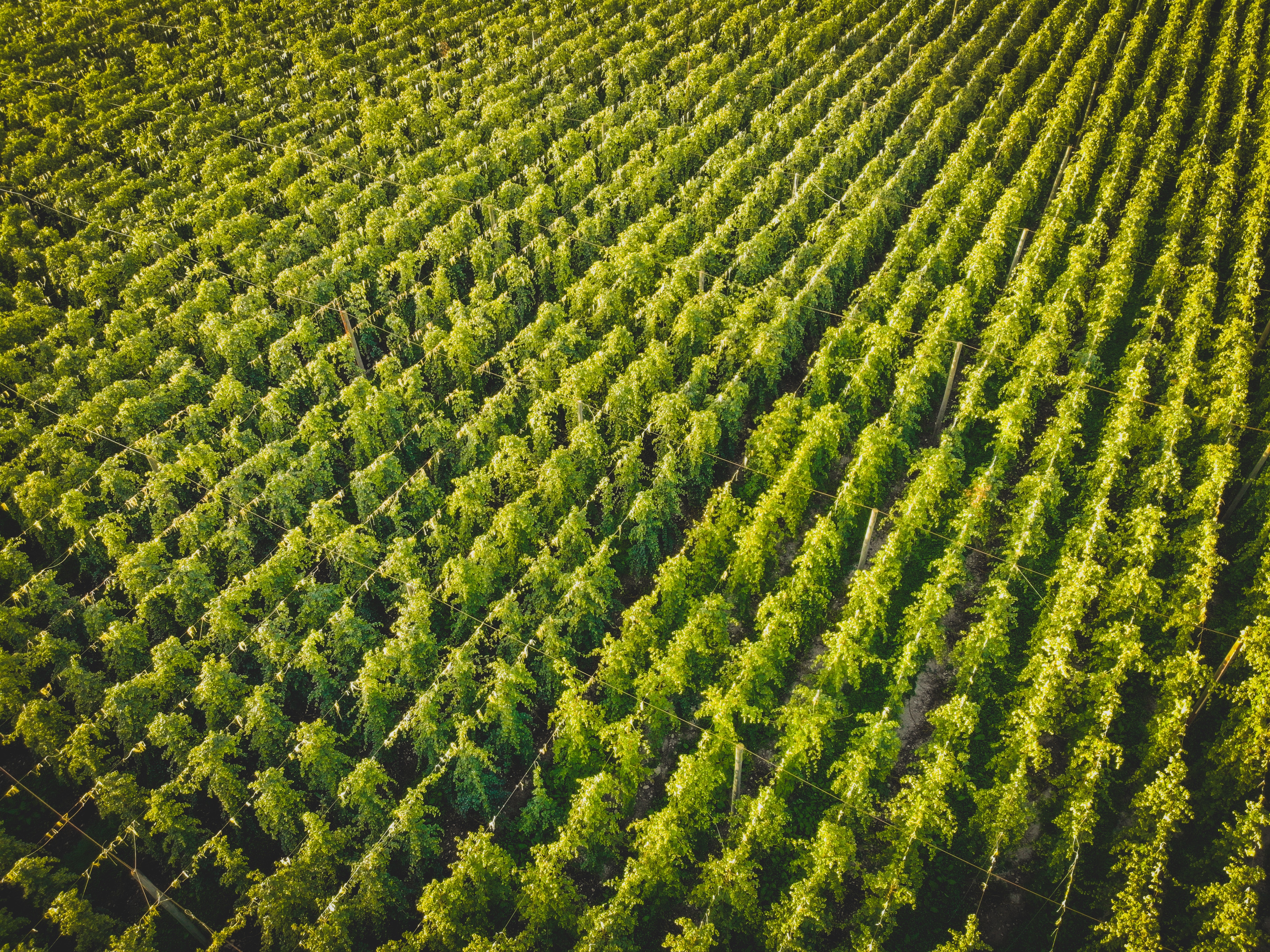
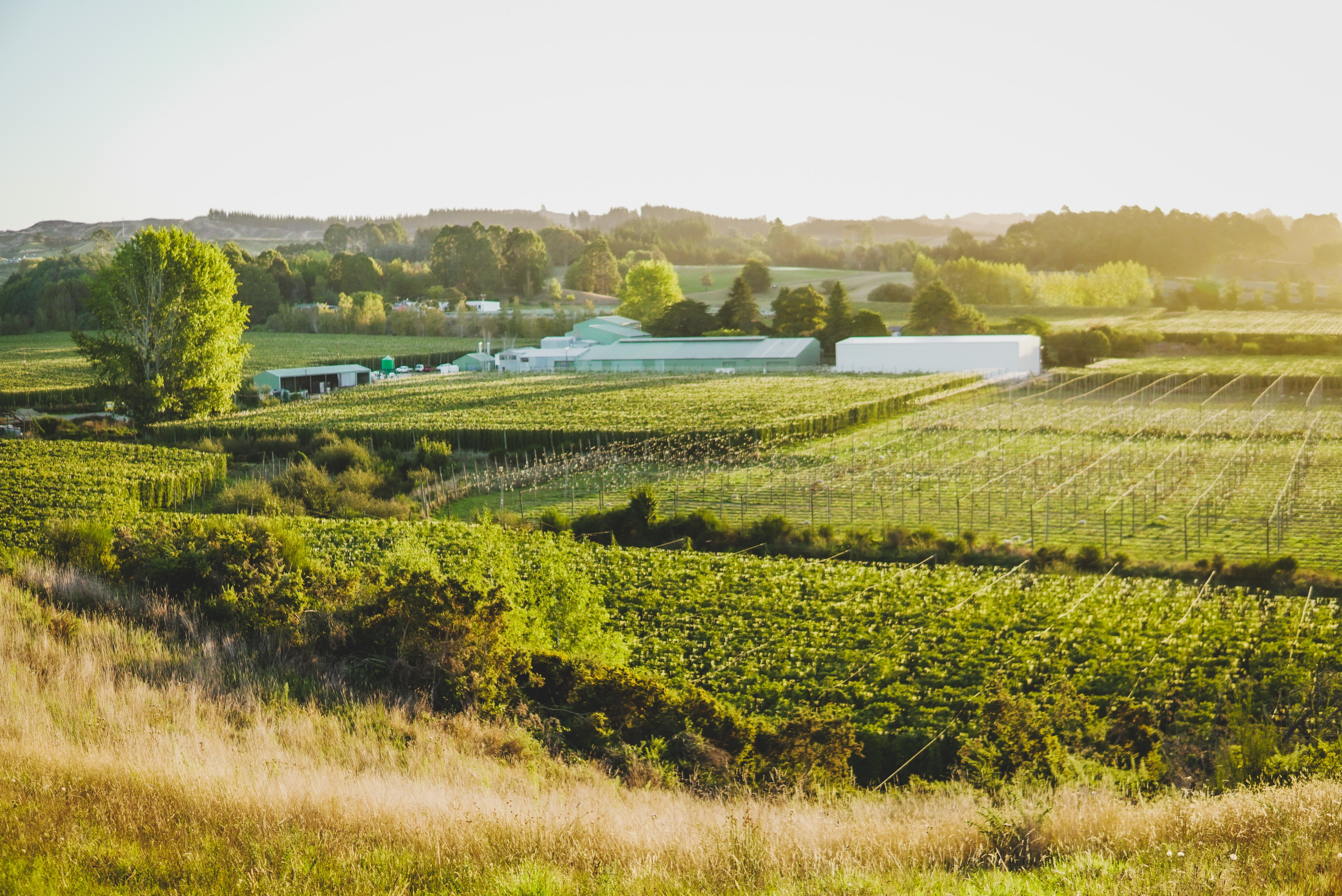
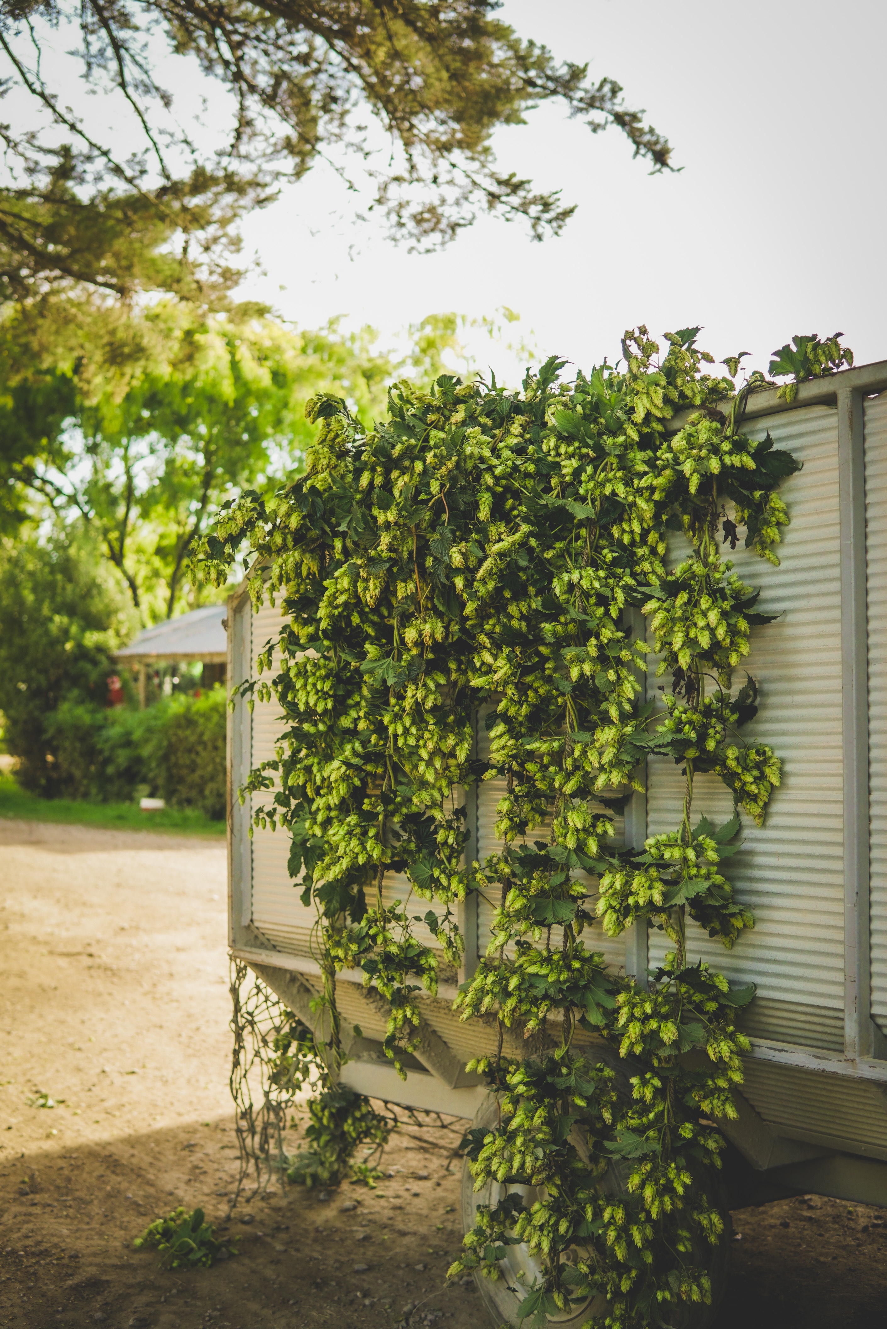
As you drive south through Riwaka to Motueka and Upper Moutere in March, you will notice the abundance of hop bines fully grown and ready for harvest. The process from picking, drying and packaging takes 49 hours in order to preserve those farm fresh hop aromas, and then sent to various brewers around the world. The hops from the Nelson-Tasman region are internationally recognised and sort after, and it was awesome to see the harvest in person at Freestyle Hops in Sunrise Valley, Upper Moutere.
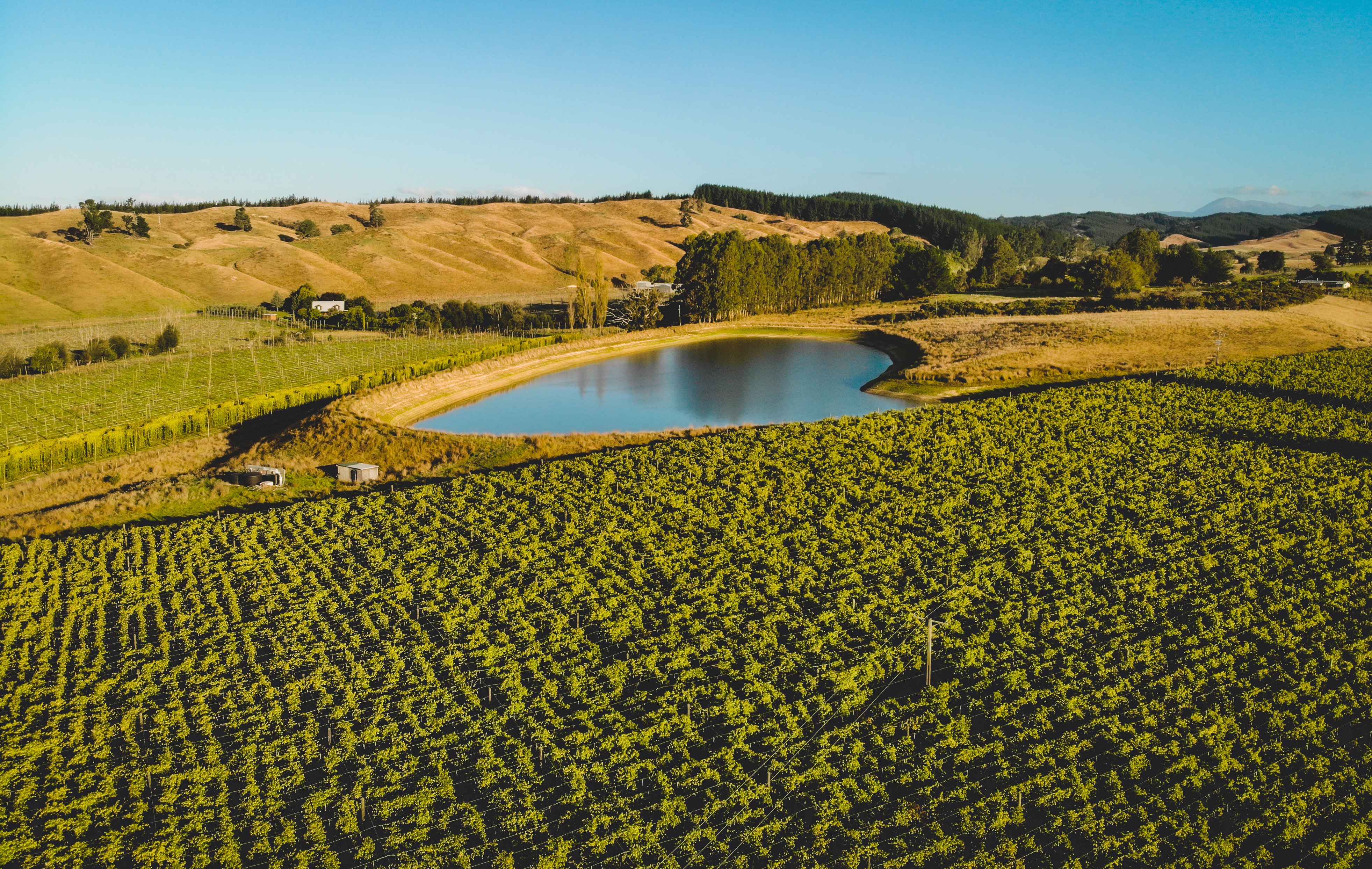
Right next door is the Moutere Hills Vineyard and wonderful Forsters restaurant, serving up seasonal longboard platters alongside a creative menu. You can dine inside or out in the garden, and their honeycomb and white chocolate cheesecake is to die for 🙂 In Upper Moutere, make sure to stop by the Moutere Inn for a casual drink or a meal. As New Zealand’s oldest pub*, there is a homey charm to the establishment, serving up good grub and local beers on tap. They also have a bunch of events/themed nights going on throughout the month, including curry night, steak night, quiz night and live music performances.
*When you google ‘New Zealand’s oldest pub’, many names pop up including the Duke of Marlborough Hotel and Thistle Inn, but the Moutere Inn is the oldest pub in it’s original building, established in 1850
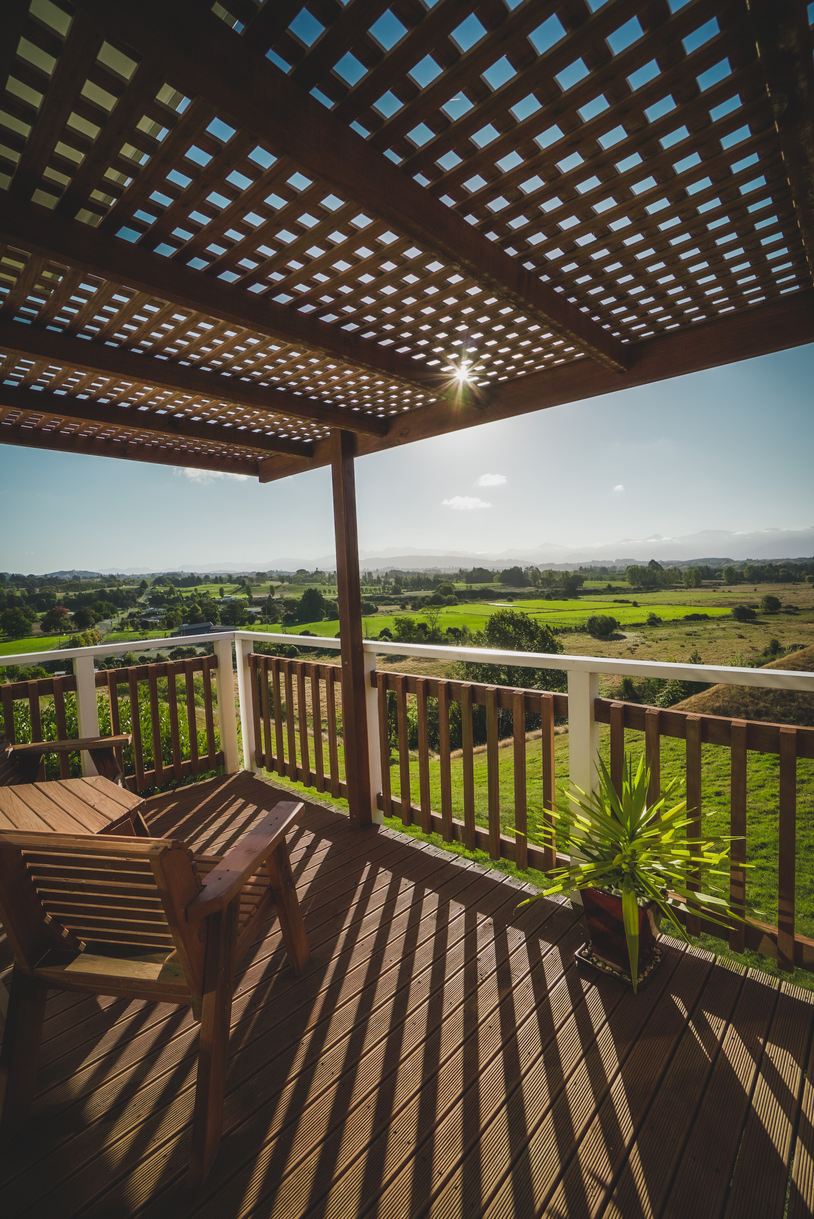
We stayed around the corner at the Tasman Hill Lodge, a peaceful family owned lodge with mountain views over the valley. You are free to wander and picnic around the 30 acre property that features ponds, a swing and an olive grove, and it is a great base for heading over to the Māpua Wharf for a stroll and some food. We enjoyed meals at Jellyfish Restaurant and The Apple Shed Kitchen & Bar, but you also can’t go wrong with fish and chips on the wharf!
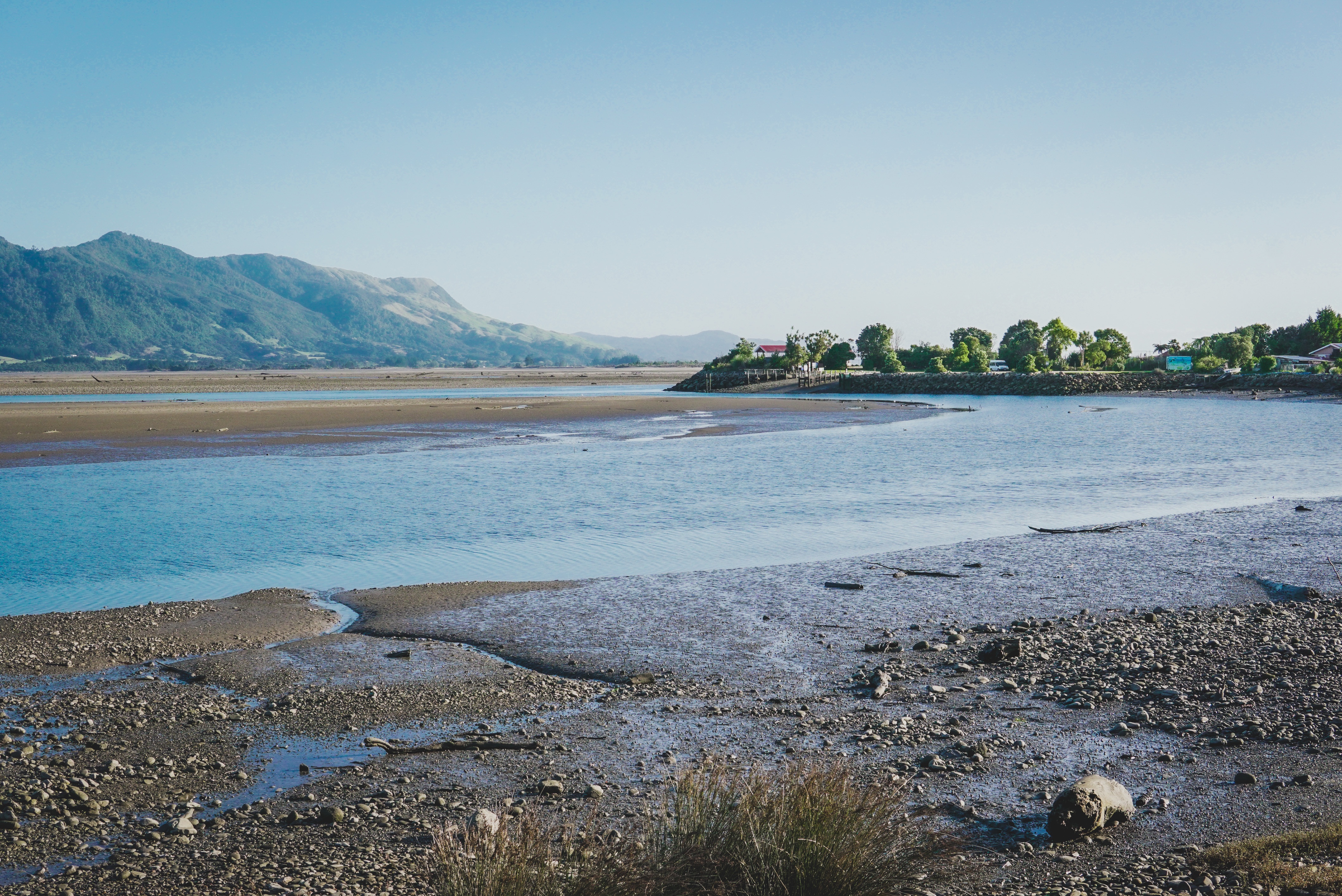
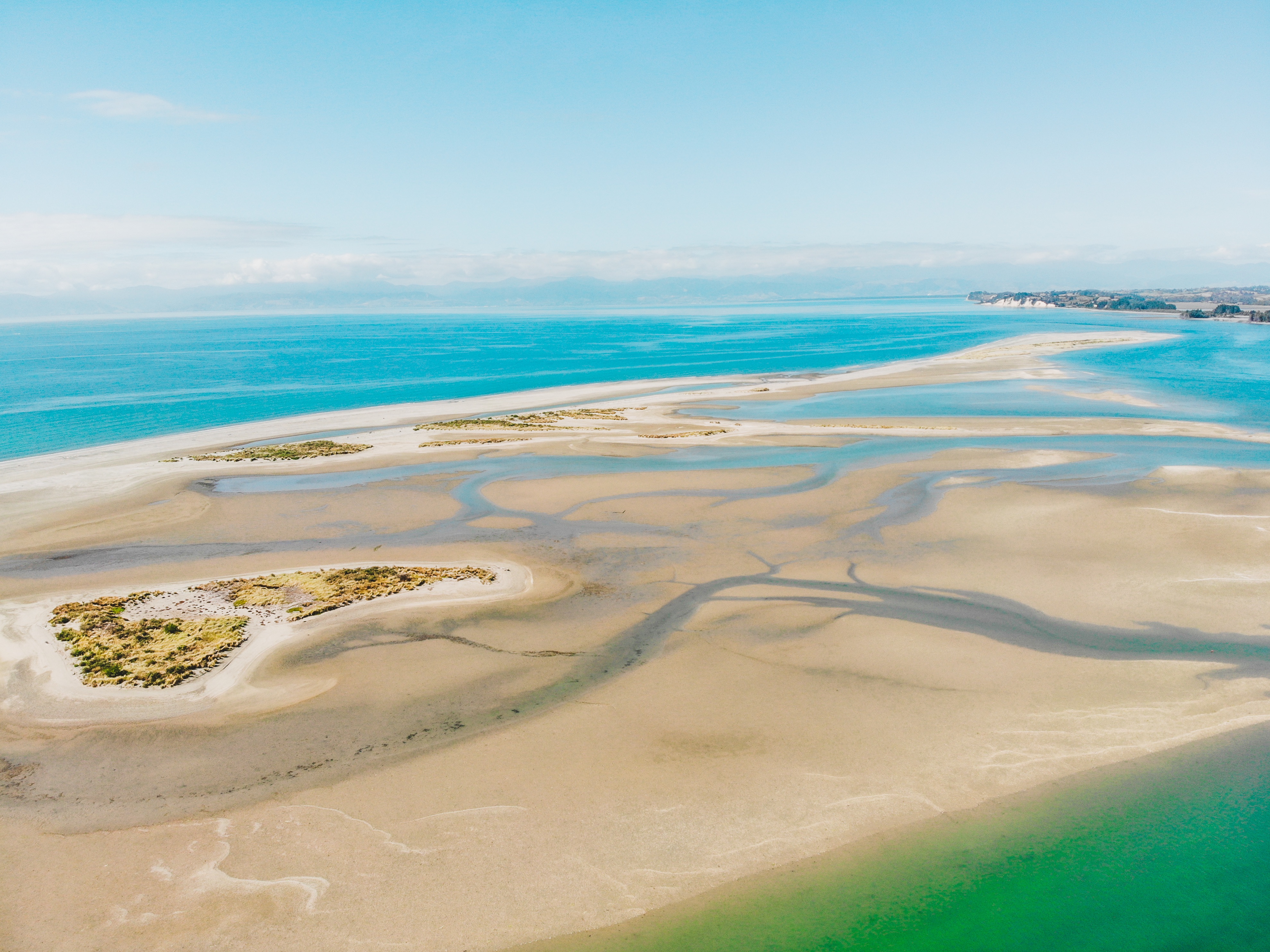
The closest major town, petrol station and supermarket to Upper Moutere is in Motueka, known as a gateway town to Abel Tasman National Park alongside Kaiteriteri. A few notable mentions in this town include the Janie Seddon Shipwreck, the Motueka Sandspit and the Saltwater Baths, and we had delicious gourmet doughnuts and lunch at The Smoking Barrel.

On our way back to Nelson and before Richmond, there is a left turn off to Rabbit Island, which can also be accessed via a 10 minute ride on the Māpua ferry. The 13km stretch of white sand beach is perfect for a walk, swim, kayak or picnic, there are tables and barbecue facilities on offer as well as an abundance of cycling trails. 6.8 km of the Tasman Great Taste Trail runs through Rabbit Island, with the entire loop trail highlighting urban, coastal and riverside scenery as you pedal from Nelson to Kaiteriteri and back.
Check out our week in the Tasman region in the video below, and marvel at the scenes that had me thinking I was in some overseas tropical island paradise 🙂
Hola LILIAN.
Me tienes impresionado con la belleza y profesionalidad que muestras las imagenes y
los videos. Gracias por tu dedicacion eres un encanto.
Tu mas sincero y humilde admirador, Fausto.
Beautiful, Lilian. If you need any helpers with your videos, just contact me. I am Maria, from Spain .